Ryan Chester on Chicago Rebuilt: Seeing Yesterday’s City Today
Introduced by William J. Bowe
The Cliff Dwellers · Chicago · September 15, 2026
Contents
Bill Bowe Welcomes the Audience 00:00
Thanks, Two Books and a Team 00:28
Constant Sketching and a Bigger Project 04:02
Drawing the Whole Chicago River 07:14
The Eastland and the Lost Union Station Concourse 09:09
Clues in the Chicago Flag: Fort and Fire 13:43
Two World’s Fairs and the First Skyscraper 15:55
Lost Landmarks and an 1893 Guidebook 18:28
Survivors of 1893 and the Montauk 21:36
The Seven Great Railroad Stations 24:58
The Lost Railroad Stations of Chicago 26:44
City Hall Through Its Many Versions 33:41
Home Insurance Building and Marshall Field’s Wholesale 36:17
Lost Loop Landmarks, Field’s to Ward 37:51
The Federal Block: Custom House to Mies 42:54
Soldier Field, Union Station and Prentice 46:13
More Lost Landmarks of the Loop 49:14
Clubs, Stadiums, Stockyards and the Midway 53:03
Summary
Ryan Chester
Editor’s Note: On September 15, 2026, members of The Cliff Dwellers and Chicago’s architectural historians gathered at the club to hear architect Ryan Chester preview his forthcoming book, Chicago Rebuilt: Seeing Yesterday’s City Today. Past club president Bill Bowe welcomed the audience and introduced the speaker.
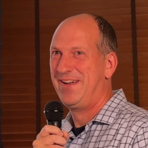
Chester, an architect with twenty years of experience, explained how his one-hour lunchtime drawings grew into a 55-foot scroll of both banks of the Chicago River, published by the University of Chicago Press in 2023 as Chicago Reflected. Two things in that drawing no longer exist: the SS Eastland, which capsized in 1915, and Union Station’s concourse building, demolished in 1969. The lost concourse sent him looking for what else Chicago has lost.
Taking clues from the four stars of the Chicago flag and an 1893 Rand McNally bird’s-eye guide, Chester redrew vanished landmarks as if they still stood among today’s streets, cars and towers. He focused on ten sites, among them the great railroad stations, the successive City Halls, the Home Insurance Building, H. H. Richardson’s Marshall Field’s Wholesale Store, Henry Ives Cobb’s Federal Building, Soldier Field as it once opened onto the Field Museum, and Prentice Women’s Hospital. A quick run through the book’s remaining drawings followed, from the Iroquois Theater and the Union Stock Yards to Frank Lloyd Wright’s Midway Gardens.
Chester worked with historic preservationist Vincent Michael, the book’s author, and photographer Tom Rossiter, and he thanked the Driehaus Foundation and the University of Chicago Press. The project has been invited to the architecture biennial in Venice next May, where drone imagery and AI animation will bring the drawings to life. Chicago Rebuilt is due in early 2027. Answering questions, Chester said that progress will always bring a fight over what to save.
Transcript
Lightly edited for clarity and readability; false starts and repetitions have been removed, with the substance of each remark preserved. Timestamps indicate where each section begins in the video.
Bill Bowe Welcomes the Audience
00:00
Bill Bowe: Welcome, everybody. We’ve got a terrific program for you tonight. I’m Bill Bowe. I’m a past president of The Cliff Dwellers, and I have an interest in this subject, the way all of you obviously do. Ryan Chester is going to give us a mixture of photos and sketches, and I think that, from what we hear, we’re going to leave here tonight after dinner knowing a lot more about Chicago and how we got to where we are.
Thanks, Two Books and a Team
00:28
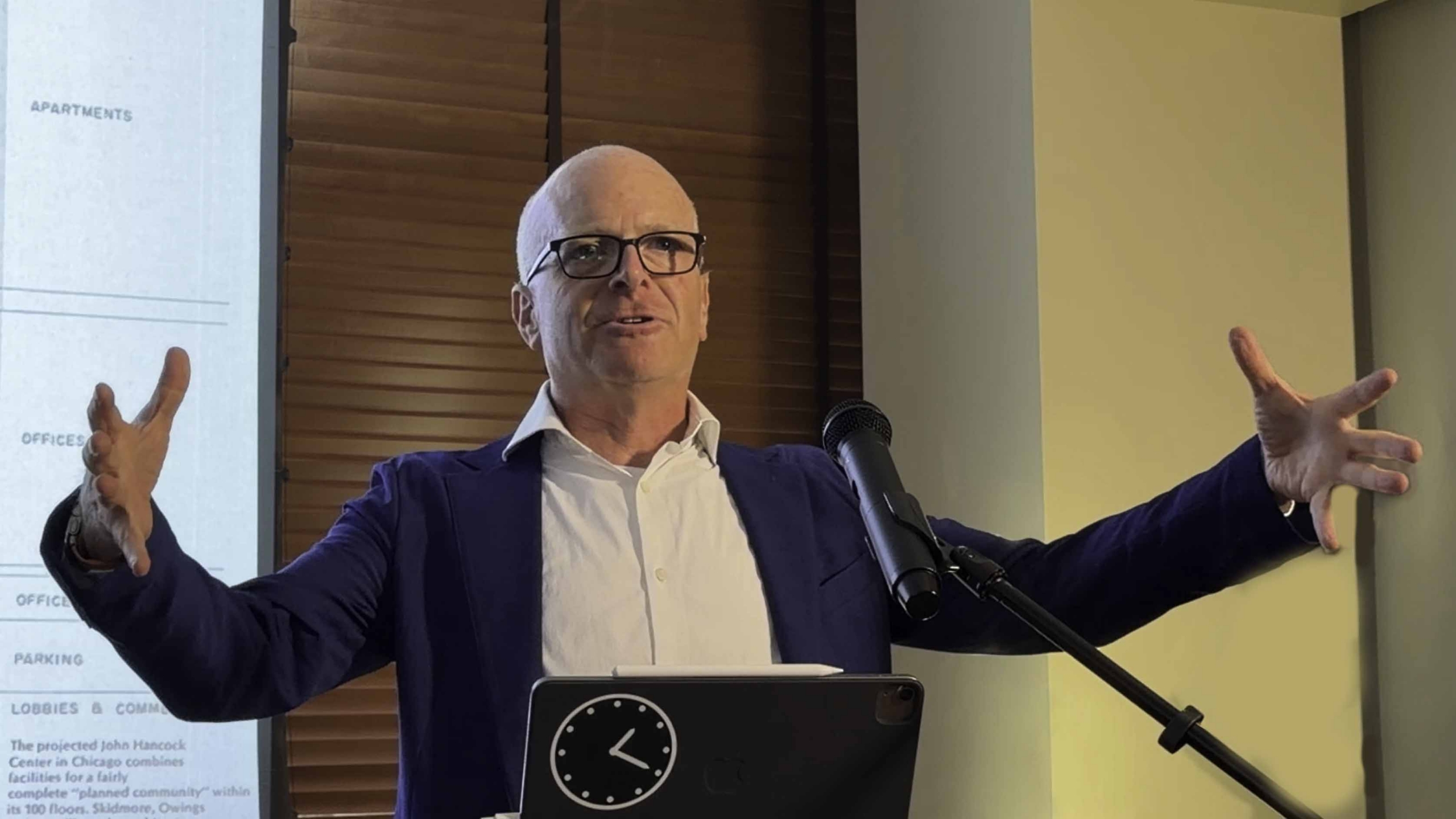
Ryan Chester: Good evening, everyone, and thank you. Thank you to The Cliff Dwellers and to the Chicago chapter of architectural historians, the Chicago Society of Architectural Historians. I really appreciate the opportunity. It’s an honor to be here and to speak in front of all of you. It’s just incredible to look out on our beautiful city as we speak about our beautiful city, so it’s a fitting place to be.
This is the first of, I hope, many lectures that I will be giving on my second book, which is entitled Chicago Rebuilt: Seeing Yesterday’s City Today. My first book is entitled Chicago Reflected, and I will touch on it in the beginning part of this presentation. If anyone is interested after seeing it, I have a few copies for sale at the front table here, so after the presentation, during dinner, or at any point in the evening, I’d be happy to help. But I’m not here to sell books. I’m just here to spread the good news about all the things that Chicago has to offer, not only in its present but in its past.
I should start off by saying that I’m also not a historian, and I’m not a preservationist. I am an architect, but I appreciate good design, and I appreciate the things we have in our city that have a legacy. There’s a memory there, and their stories are worth telling. Without these stories, many of us, maybe even some people in this room, even if you’re a historian yourself, might not be familiar with a lot of the stories and buildings that I’m going to be talking about. So, again, thank you for inviting me, and for your attention and your interest, because without interest this presentation would never be given and the stories would never be heard. Thank you.
This project came, as I mentioned, from a previous book, but it has taken on a life of its own. I am Ryan, and I have 20 years of professional experience as an architect. I grew up and went to school in Milwaukee, so I’m originally from Wisconsin. After graduation I lived in Milwaukee, then I moved to New York for a few years and to London for another three or four years, and I’ve been back here in Chicago for the past 15 years. In that time I’ve done quite a few drawings of the city. I try to draw it as much as possible, not just for this project but in general, every day if I could.
As for the other names on the list here, the book actually has an author, Vincent Michael, a historic preservationist who now lives in San Antonio, and Tom Rossiter was the photographer. He’s an architectural photographer, and you’ll see some of his photos here in the presentation as well. The project has also taken another interesting twist: we were invited to participate in the architecture biennial in Venice, which is coming up in May of next year.
So we’re going to be introducing drone imagery as well as AI technology in order to animate these drawings, to make you really feel that you’ve come into a site you identify with. You know it, you’ve walked past it, and suddenly you see what was there; right in front of your eyes, you see that transformation. So this is the group of people that I’ve relied on heavily. It’s not just drawings. Drawings can be static, and they don’t tell the story as well as when you can really get into it with animation.
Constant Sketching and a Bigger Project
04:02
Ryan Chester: As I mentioned, I’m one of a dying breed of architect: I just want to draw all the time. These are just two images that I pulled from recent sketches from this past summer. The image on the left is from the citizenM’s amenity deck on Michigan Avenue, just south of Wacker Drive, looking north. The other is one of the sketches that I did with the class at the School of the Art Institute this past summer, from Maggie Daley, looking towards where we are right now.
These are the kind of drawings I would do in an hour, maybe over lunch, or in two hours, and then that’s it. It’s done. I take a photo of it and that’s the end. I don’t work on these very long. I just like quick thinking, constantly analyzing and seeing things, whereas if you’re not drawing and you just take a photo, you don’t really experience it in the same way. You don’t really analyze the proportions and the details as you do when you’re making a drawing. So I try to do as many of these as possible, and those are done during the warm months.
Unfortunately, Chicago has this other season, which is not very conducive to drawing outside. In that case I still want to keep drawing, but I have to do it by other means, whether that’s looking out of the window (this would be a great spot for that, mind you; I’d love to come back) or working from photographs. At the time these two images were made, I was working at the Wrigley Building, in the north tower, looking out of the window. Over lunch you just take a break and draw for an hour, and these are maybe from my chair or from around the corner. There are a few images here, and in others you can see the window jamb here, in its depth, and some of the detail of the terracotta, looking out through the Wrigley Building windows.
And there are other places: Google Earth gives us the ability to fly all over the world, look at any vantage point from any angle, and draw that. This is a very small drawing, very gestural and very quick, less than an hour, done just from an image looking down at Wolf Point. So during these colder months I’m always trying to keep drawing Chicago as best I can. At some point I realized I wanted to have a bigger project that would last those six months of winter.
At the base of the Wrigley Building, in the south tower at the river, there is a cafe that almost never had anybody in it; I don’t know if it’s still there. I spent three weeks there, each one of these drawings taking one hour, and each of them individually isn’t very impressive. But if you put them all together you have something, something big, and the river has so many features and architectural pieces that are worth drawing and analyzing. I drew something like this, and then the following year I decided to take it a bit further. This is where Chicago Reflected started. This is just before the pandemic started; it would have been November or December of 2019.
Drawing the Whole Chicago River
07:14
Ryan Chester: I thought, if I can do three drawings in three weeks, what if I did the entire side of the river? My idea was one foot of drawing every week for 24 weeks; that would be a 24-foot-long piece of paper. I went to buy a roll of printer paper, like a scroll, and I would only be able to see the one foot that I was working on, or two feet; beyond that it would be rolled up. That first year, in the first six months of winter, starting in 2019 and ending in April 2020, I drew this side of the river. Then it was summer again, so I stopped. And then I realized that, having gone this far, I might as well turn around and go all the way back to the lake. This is the result of that.
On the upper left, you can see Lake Shore Drive. I go past Jeanne Gang’s St. Regis Tower and Michigan Avenue, all the way across, and at the end of the first six months I stopped at Bertrand Goldberg’s River City. Then I turned around and went all the way back. On the opposite side, all the way at the bottom, on the lower left, is the Cardiss Collins post office extension. Then I come all the way past Wolf Point again, past Marina City, past Michigan Avenue again, and all the way out past the locks towards the lake. So this is the first book, done.
But there are details in here that led me to start thinking about the second project, which I’ll be speaking of. This is just a detail; maybe it’s a bit easier to see the scale. The original drawing was on one single roll 55 feet long; that’s both sides of the river. It has been reduced to about a quarter scale in the published version, which looks like this. That’s 2023, University of Chicago Press; they did a great job with it.
The Eastland and the Lost Union Station Concourse
09:09
Ryan Chester: There are two things that that book brought back to life and made me start thinking about. The first was the tragedy of the SS Eastland. I tried to draw as many boats as I could think of that go up and down the river today, and then in my research I found this, which I didn’t know much about. In 1915, this giant ship — it is amazing even to think of a ship of this size being able to go into the Chicago River, but it did — capsized onto its side, and over 800 people died. A lot of people don’t know that this happened, but the event is commemorated every year with a wreath on the river; I think it’s in June or July.
By the way, since I’m not a historic preservationist or a historian, if I get any of my facts and figures wrong, feel free to speak up and correct me. Otherwise I’m going to give this lecture ten times and they’re all going to be wrong, so correct me early. This giant ship is the only moving piece of the puzzle here that doesn’t exist today.
The other thing that I did not draw as it exists today is the demolished Union Station concourse building. We lost that in 1969. It was built between Canal Street and the river, along with its partner to the west, the Great Hall, which we’re all familiar with. We lost this, and I didn’t draw what’s there today because I felt a connection to this building. I really appreciated it for what it was.
Living and growing up in Milwaukee, we always used to come down here by train. The Great Hall was amazing, but you would always enter and leave Chicago through the saddest waiting place. The way you board trains today is just awful. And it’s so sad, because when you think about what was there, it was the exact opposite experience. This building really is the reason that I started looking at what else we have lost. What else was there that we lost because of progress, or things becoming obsolete, or bad construction? I’ve heard it all in the research.
That’s what’s there today, and these are the buildings that I didn’t want to draw, because I knew what we had on the river there before. You can see on the very far left the other half of Union Station, which exists today and which you enter now. Yes, and we have the exact same situation now. Union Station has always been a very special place to me, because that’s how I always entered Chicago from Milwaukee growing up. We never drove; we took the train. This is the station that we see and think of when we think of Union Station, but it’s only half of what we once had.
So I started drawing Union Station a lot. The image on the left is from a photograph. As for the image on the right, I got there a little early for my train one day, so I drew this line drawing in the waiting room. There are always good ways to use your time; it’s not just looking at your phone. In case any of you are interested in drawing, it’s a great way to kill some time.
Union Station has so many great vantage points to take advantage of if you want to capture a good image. On the left, that’s me standing for 45 minutes to an hour, drawing all the way down to a section perspective. The image on the right is actually on a five-by-five napkin, so it is very small; that’s why it maybe looks a little fuzzy. Those are the same stairs that come off Canal.
I also did one of what it would have been if the concourse building were still there. We can see the river and a few tracks that pass along the river, and then the concourse building itself, cut as a section perspective. The ghosted view that you saw at the start of the presentation is seen here. That is the space you would go into before reaching your train platform, had this building not been demolished. Just think about the lay-in tile ceiling eight feet above your head; that’s what you go through today, and this is what was there. This struck a nerve with me, and it is why I started this project.
Clues in the Chicago Flag: Fort and Fire
13:43
Ryan Chester: Because this presentation is going to be given to a lot of different audiences, and I’m going to be using a lot of these slides to take it to Venice, so that the world can see Chicago as we all appreciate it, I have a lot of slides here that I don’t really need to read. They are more for the information of people who don’t know Chicago very well, so I’m going to go over them quickly. But I started thinking, what else can I find? Where can I find information on other buildings, clues to great examples of buildings I could draw from?
I know the symbol of the Chicago flag; we’re all aware of it. Originally it had two stars, and then three and four. I’m not going to go over the order in which the stars were added; I’m not really interested in that, but I wanted to understand what the stars meant. If you don’t know what the stars mean, the easiest way to remember is fort, fire, fair, fair. Those are the four. Fort Dearborn, 1803: I actually thought about making this one of the buildings that I would document, but it would be so hard to recreate it in a modern gridded city. So I said, okay, I’m not going to attempt that.
The fire is the second star. I’m not putting these in the order of the flag; I’m just going chronologically. In 1871, the fire destroyed City Hall, and I did draw City Hall as it stood, as if it had never been demolished. I’ll show you that drawing in a moment. It was one of the more monumental buildings of its time to be destroyed. Yes, please? Okay, you caught it, thank you so much: October, yes, good. See, this is why we have these presentations. I don’t know, maybe I was making the slide on March 8th. The text has it right, but at the top it’s wrong. Thank you so much.
Two World’s Fairs and the First Skyscraper
15:55
Ryan Chester: This is 1893, the World’s Columbian Exposition. I drew this, the Statue of the Republic and the Administration Building. The weirdest thing happens when you start looking at these things. The Phrygian cap on top of the staff is there in 1893. The one-third reproduction that’s in Jackson Park today doesn’t have that cap; it has a cross. I did not know that there was a difference. Why would they do that? I’m sure there’s some symbolism about the cap, and maybe that’s why they got rid of it, but that’s a rabbit hole I didn’t really feel like going down. So in my drawing I have the cross, and there’s a garland that wraps around it. For those with keen eyes, it’s an interesting question why it was changed; I don’t know.
And then finally, the Century of Progress in 1933 and ’34. I find this one interesting because you see how Soldier Field opened up onto the Field Museum; there was no grandstand there. There was a colonnade on the east and west, and the Field Museum basically created the northern edge. Then it was built up, changed and modified, and now you don’t have anything like that to the north. The towers here, at the time they were built, were the tallest pieces of built architecture or design in the city, at over 600 feet tall. They were imploded with dynamite after the fair, but they were impressive in their own right. The Sky Ride, as it was called, carried double-decker gondolas all the way across between the base of Soldier Field and what is now Northerly Island. That is another interesting piece of history that came from the four stars of the Chicago flag.
We all know that Chicago is recognized as the birthplace of the skyscraper. I should say that historians have a tough job, because everything I look at says, “This is the first, this is the biggest,” or some other superlative. It seems you can always go somewhere else and find someone who says, “No, that wasn’t the tallest, that wasn’t the biggest; this was.” It’s always a back-and-forth. We always think of the Home Insurance Building as the first true steel skeleton building, and New Yorkers would argue with this, as I’ve seen in some of the research. But we accept this to be true.
Lost Landmarks and an 1893 Guidebook
18:28
Ryan Chester: I bring this slide up because, as an architect and someone interested in our city, there was a series of buildings I had always known about that had been demolished, but I didn’t know where they were or what their stories were. There was the Home Insurance Building, because of the claim that it was the first truly skeletal skyscraper in the world. Later came the Garrick, or Schiller, Theater, which was a very iconic building as well.
The other two I had on my mind were the Masonic Temple building, for which, in my research, some would even make a claim about the time it was built that I did not know (and again, historians have it rough, because people will contradict this), and the Chicago Stock Exchange building, because we have fragments of it: we can see it at the Art Institute, and even the great arch that was its entryway has been preserved. I have redrawn these buildings as part of my research and for the book.
Once I had a big collection, I also started reaching out and looking at these other books that come back to a lot of what I’m interested in. I took clues from them, I built on what they found, I would choose some buildings that they had also described, and I would add to them. So my project is not just a comparison of before and after, but a what-if: what if these buildings weren’t demolished? We could see them with cars that look modern and with neighboring buildings that we are familiar with, that we pass by every day. It’s really striking to see some of these. With some of them I think, okay, I like the building that replaced it too, but most of them are sad, let’s put it that way.
I went through other books that offered a lot of insights, but the one that really stood out was this Rand McNally’s Bird’s-Eye Views to Chicago. It was originally published for the World’s Fair in 1893 and was reprinted once or twice after that. I bought this book, and I actually have a copy with me if anybody is interested. It’s new, a reprint; it’s not as if I have an antique with me. But it’s the drawings: I’ll show them, and I’m going to show how I got to where I was with those drawings. I read this whole book.
It’s incredible how people used to write, the words they used, how they would describe things, and how insensitive they sound to a modern person. Everyone was a man back then; everything was “he, he, he.” It was always directed to a man, and how they talked about minorities was unbelievable, sometimes just shocking. So reading this book really takes you back in time, not just through the imagery but through the way it’s written. And some things are so funny: I remember laughing out loud, harder than I have ever laughed before, and it’s not a comedy. But the drawings are phenomenal and very informative.
Survivors of 1893 and the Montauk
21:36
Ryan Chester: I’ll start off with a few of the monuments that were there in 1893. We don’t have too much: more or less 95% of the city that was there at that time is gone. Of course, the pumping station and the Water Tower were there, and we still have those. You can see these aren’t really drawn to scale; everything looks a little tight together. Michigan Avenue north of the river used to be called Pine Street, so it’s labeled as such here. Just across the street from where we are now, you can see the Art Institute, which had just been built for 1893.
At the foot of Van Buren Street, at the top of the image, there is a bridge that goes over the train, and that ferry would take people to the World’s Fair in Jackson Park. You can see all the little trees; everything is very small relative to the plantings we have today. But look at how close the lake was, just on the other side. Where Grant Park was, there was really nothing compared to the size it is today. Just on the other side of the tracks, we have the lake.
A few buildings we do still have: the Old Colony Building and the Manhattan Building are in this image. At first glance you just pass over these buildings; you don’t really see them, because all the buildings look very, very similar to one another. The scales are all alike, with punched openings, and they’re all masonry. This is a very unusual view: we’re looking southeast. In the middle of this image today, right through the center here, would be Ida B. Wells, so it just took out half of all of this. In this corner right here there’s a modernist building, there’s a gas station here, and Harry Weese’s jail is here. That’s just to give you some idea of how things have changed.
We have a couple of these buildings that survived, and I had to draw them the way we would see them from the road today. Now we’re looking north. In the back is the Fisher Building. These are the tracks on Van Buren Street, the L. That’s the Fisher Building, the Old Colony and the Manhattan Building. Those are some very early skyscrapers that fortunately were not torn down.
But in this book from 1893, the Montauk Building is the one they call out as the first true skyscraper, with a skeletal frame, which I had never heard of before. I had never heard of the Montauk Building. It is a 10-story building. Burnham & Root actually had their offices in this building when they were designing the Rookery. It’s a nondescript building, with nothing too ornamental about it. If it stood today, it would be on the plaza of Chase Tower, across the street from the Italian Village. You can see the Chase Tower to the left, and this is Inland Steel, so we’re looking toward the east. That’s the Inland Steel Building, and I think this is the Xerox Center by Helmut Jahn.
This kind of thing really fascinated me: the idea that we had these buildings, they’ve all been destroyed, and we just see the city as we’ve always known it. We don’t think about how it used to be; we accept it for what it is. But there are so many examples like this. And when you read this Rand McNally book, it really talks about the unbelievable nature of the Montauk being the first skyscraper made of steel, and it was only ten floors.
The Seven Great Railroad Stations
24:58
Ryan Chester: The next thing I really came to focus on is that in 1893, of course, there was very little road traffic. Not very many horses were coming from long distances to see the World’s Fair, so it was all about train travel. The book talks about the seven great stations of Chicago: what happens when you get to the station, how you walk out of it, and what you see if you turn to the left and what you see when you turn to the right, in great detail.
Guidebooks today just say, “Hey, there’s a building there, look at it.” But this is about how you feel when you get out of the station, or if you come by boat across the lake: the air, what it feels like. You should arrive at this time of day so that you’re not disoriented when you get off, and you come in the next day so that you’re refreshed. It talks about all these things; it’s very atmospheric.
Anyway, these seven great stations and depots: the book lists seven, and there are a few others. It lists the sixth as Nickel Plate Station, which is a transfer station. I don’t know why they called it one of the great seven; I’ve never even seen a photo of it. Has anyone? Yes? It did, yes. Aside from Nickel Plate, these are all well documented, and I’ll show you examples at the end of the presentation. I’m not going to bore you to death by talking about 40 different sites. I’m only going to focus on 10, and at the end I’m going to show all the drawings that will be in this book, so that you can take a look at them.
The Lost Railroad Stations of Chicago
26:44
Ryan Chester: But I’m just going to highlight a few. The stations were a big deal, and, just as today, numbers eight and nine were governmental centers: the City Hall and courthouse, and the Custom House and post office. Those sites have had many different iterations of government buildings on them, and I touch on a few. There are even more than what I discuss or what I found. I talk about maybe the last two or three on those sites, but there are many more, if you want to dig.
Obviously our history as a built environment is relatively short, only 150 or 200 years, but we’ve done a lot of building and a lot of tearing down. I’ve actually been reading a book that maybe some of you have read recently. I think it’s Fire and Clay by Will Quam. In that book there is a mention that even by the turn of the century, in 1900, there had already been five or six iterations of Chicago.
The first one is Wells Street Station. Every building in the image on the left is gone, including Wells Street Station, which stood on the site of today’s Merchandise Mart. This drawing is relatively small. At the time the station was built, in 1881, there was no L, but by the time it was demolished there was an L. It doesn’t look like the Merchandise Mart station today, but there was a train that traveled in front of it, so I drew it with the L ghosted. You can see that the L is coming across the image here, then it vanishes, and then it reappears on the other side, to show you the building behind the L.
Union Station, the one we know today, was built in 1925, but in 1893 the Union passenger station existed very close to it, one block to the north of the current station and on the east side of Canal Street. Today the Great Hall would be here, and the concourse building that I talked about earlier would have been between the river and Canal. This is what that station would have looked like if it had never been torn down for the new station to be built, which was then torn down also.
Grand Central and Van Buren Street Station, which is now LaSalle Street Station, are relatively close to one another. Grand Central Station was demolished in 1971, so some of you might actually remember when this was still there. There is now a multi-unit condo building of maybe ten stories there, and in its lobby there is a very big mural of this building. If you’re curious, the site is at what used to be called Fifth Street, which is Wells today. Fifth, or Wells, and Harrison, on the southwest corner: that’s where that building once stood, with a huge tower and neon signs. This one is well documented; you can find many images of it.
The other one did not make it into the book in this form. Van Buren Street Station has gone through an incredible amount of change throughout its history, and this slide shows you all of the different points in time when it was built, destroyed, rebuilt, modified and destroyed. You can see how I’m twisting things here, because the modernist building on the left of every single one of these images is what’s there today, so that it all comes together at the end: that’s Helmut Jahn’s addition to the Board of Trade. But in the back, on the upper left, that’s the way the Van Buren Street Station looked up until 1871, before the fire. After the fire they rebuilt it; that’s the image in the middle on the top, a little more exuberant, with some of the windows and their groupings changed.
Then, in 1887, the L had not been built yet; in the next iteration the station was enlarged and raised again, using the same building form, and during its lifetime the L came in, on what was actually the last part of the Loop to be built. I know some of you might say there was never a steam train on that part of the Loop. There was a steam train that ran on what is now the Green Line, west of Chicago, but I couldn’t resist drawing it on this, so I did it. I know that it’s not right.
After 1903 the L was there; that version of the station I did draw in greater detail in the book. You can see that now the trains are different, and there’s a car instead of a horse-drawn carriage. Then finally, 1981: that’s when that skyway was built over a more modern-looking L, and I drew a DeLorean in there because that’s when they were being built. This is just one of the sites, and you can see how many times we build, tear down, modify, tear down and build again. Just one site. Each of these has a story, and every single one of the sites that I’ve highlighted has even more layers of the onion to peel away to find something new.
Dearborn Street Station: we’re used to seeing it like this today. It used to have big gables and wood-frame attics, but there was a fire in 1922 and they never rebuilt them, so what we see today is the decapitated version of the station. Service ended in the 1970s, and now it’s an underutilized medical office suite. I think when our kids were first born, that’s where our doctor’s office was.
12th Street Station, also known as Illinois Central Station, is the one at the very far end of Grant Park. 12th Street is what Roosevelt is today, and what they then called Michigan Boulevard we now know as Michigan Avenue. Just north of Roosevelt we would have had this station, which is very close to where we have the Museum Campus station on the Metra and South Shore electric lines today.
This is the image that I drew: the station as it would be today, with the giant towers that now exist on the south side of Roosevelt Avenue, south of the park. The scale here, as you can see in the drawing, isn’t quite right, because they smashed it all together, but I think the idea of seeing it in this context is very interesting. These drawings really helped me locate where each of these is relative to the city. Even though things have changed so much, most of the street names are the same, though some of them changed. Looking at these images helped me to start my research.
City Hall Through Its Many Versions
33:41
Ryan Chester: These are all the places that I’ve analyzed throughout this project, and I’ve talked about a few of them. Most of them are in the Loop, but there are a few elsewhere, like the Palmer Mansion on Lake Shore Drive, which is number 22, Chicago Stadium, West Side Grounds, Soldier Field, and a few 1893 World’s Fair sites as well. But I’m only going to focus on these ten, because I think they’re a good sampling, and I’ve already spoken about some of them.
The seventh City Hall is the building that was there in 1893. It’s a Beaux-Arts kind of building, and we still have the city and county in one space, one building. This building did not last very long at all. It was also built on the same site as the City Hall that was destroyed by fire in 1871, the building that Abraham Lincoln would have been familiar with. That building was itself added on to many times, with two different wings. It’s an Italianate kind of design. The image that I chose to show here is without its additions. It had wings off to the side, but for simplicity’s sake I felt it was more pure in its original state.
So these are the three types. There is the one that we had before the fire; then the City Hall had to move into other temporary locations before the building that was built in 1885 came along. That one, as you can see, did not last long at all: 20 years. It’s amazing to see a building of that kind of monumentality and ornament lasting only 20 years. Then, after that was demolished, we have the City Hall we have today.
If that little Italianate City Hall had never been demolished, it would look a little bit like this, where you can see the Thompson Center really revealing itself to you as you peek around Daley Plaza. This is looking towards the west, with Clark Street in the foreground, at Washington and Clark, and the Thompson Center in the back. And this is the next generation of that, where I’m stepping further back into the block, so you can see the Picasso in the foreground. Those are very, very close to one another, but they are two very different scales and sizes. And again, the City Hall we have today is almost twice the height of the building that we had there. Each time it’s becoming more and more massive and filling the block.
Home Insurance Building and Marshall Field’s Wholesale
36:17
Ryan Chester: The Home Insurance Building is the one we give credit to as the first steel-framed skeletal skyscraper. In 1893 it was drawn here as number two; that’s this one. It was actually originally a 10-story building, and two floors were added on later. I also highlight the other one, number eight, which looks like a castle. That’s the Women’s Temperance Temple, which was built across the street and looked very much like a Scottish castle or something. It also didn’t last long, but it would have been very, very impressive to see. I had drawn that building too in my research.
Today the site of the Home Insurance Building is the site of the Field Building. You can see the Rookery on the right-hand side, and that’s where we would have had our Home Insurance Building. I drew it very, very similar to that view: again the Rookery on the right, and then the Home Insurance Building replacing the Field Building. So you see modern cars. I’m hoping that with these drawings you can see some familiarity on the sides, and then suddenly there’s something foreign. How does it feel to think that these buildings existed?
This is another one, much like the concourse building: Marshall Field’s Wholesale Store. It’s by H. H. Richardson, on the corner of Adams and Fifth, which is, again, Wells Street. That’s what it is today: a parking garage.
Lost Loop Landmarks, Field’s to Ward
37:51
Ryan Chester: This one cuts me deep. I know a lot of people love cars. I despise them. I try never to be in them, and I will do anything to avoid them. I know that they’re a necessary evil, but I’ve never been to a place and thought, “You know what would make this city better? More cars. Why can’t we just have bigger streets and more parking lots?” This one cuts deep, though I’m not supposed to have an opinion; I’m supposed to just tell it like it is, right? This is what it would look like if it were there today, filling the whole block between Wells and Franklin, all the way to the Sears Tower. It would have been one of two H. H. Richardson buildings still existing in the city, but now we have the Glessner House, and that’s the only one.
Next, the Masonic Temple Building. The account in the book goes into great detail about the visitors who came to Chicago: when you get to this building and have to take an elevator, make sure you hold on really tightly. It tells you how to behave in an elevator, to take it all the way to the top, and to make sure that you don’t move until it stops at your floor. This was a big deal because it had a public observation deck on top. It would have been the tallest building.
I want to highlight a few things here, just to give you a sense of place. State Street is at the bottom, and we’re looking east, towards the lake. This is the Cultural Center, the public library at the time. This is where Macy’s is today. This building is still there today; I never really found enough information about it, but I know that it’s there, and Marshall Field’s just built around it. The other building, number four, is the Columbus Memorial Building. I highlighted that building in my work too, and I drew it as well. That’s where we have our beautiful Primark today.
The Masonic Temple Building sat where the Joffrey Tower is now, with the large Walgreens at the base. This is what it would look like if it had never been torn down. I colored both the Chicago Theatre marquee and Marshall Field’s clock, just to give real context: iconic pieces of Chicago sandwiching this once-great tower. Part of the reason they gave for demolishing it was that in the ’40s, when they were building the Red Line, it was in the way. I don’t know why the other buildings didn’t get in the way, but that one did.
Then the Chicago Stock Exchange. This one hurts also, because this is the site where Richard Nickel lost his life during its demolition. We have this awkwardly placed and sited arch outside, just across the street on the north side of the Art Institute, near the Modern Wing. And, a great irony, I heard that this building, the black one, was actually being considered for historic preservation recently. It is? Okay, thank you for the update. It would have been nice if they had done that a little earlier, but the Stock Exchange was demolished in 1972. The trading floor is across the street, and I think that’s also under threat now, right? The Art Institute is looking to get rid of that as well.
This is a very square building, so I decided to focus on the details of the arch itself. I actually drew a car, the old tiny car in the back there, just for fun. But you can see, at the bottom of the image, some of the detailing in the way the base comes down in this iconic arch of the entry.
Then the Montgomery Ward Tower, which I think is two blocks north of where we are right now. Originally this was a commercial building with a very ornamental base and a tower with a beautiful weather vane at the top. The weather vane itself has a huge story that Vincent Michael writes about in the book, but it was decapitated, removed. The weather vane never turned. It didn’t really work as a weather vane; it was too heavy for the site, and so it stayed still. But they cut the whole top of the building off, redid the entire base, and then added four floors.
You can see that the proportions of this building look awful now. The tower seems awkwardly positioned: not only was it cut down, but the rest of the base was built up. So now you don’t really have the same kind of tower; it’s just stubby, with a little head on the top. This is the building you see time and time again in historic photos of Chicago, this tower that was very, very tall at the time it was built. Then, as the ages passed, the Pittsfield Tower in the background came into view, on a site very close by. So we have a very ornamental building that is still there, but its character has totally changed.
The Federal Block: Custom House to Mies
42:54
Ryan Chester: Now the other governmental center. We had City Hall and the County Building, and now, going three blocks south, we see the US Custom House, Courthouse and Post Office. I highlight this because it filled the entire block at Dearborn. I also highlight this, the Owings Building, which has a really interesting gable with a turret at the corner; I highlight that building as well in my research and drawings. This is familiar to everyone, and we still have it: that’s the Monadnock Building. We’re looking south, and this is the earlier iteration of the Union League Club, which occupies the same site in a new building today. Hopefully these give you a little bit of an idea of where we are.
That’s the Owings Building and the old US Custom House, which is actually two generations old. You’ll see the Federal Building, which replaced it, and which was then torn down for the Mies van der Rohe Federal Plaza we have today. This is probably one of the most controversial sites for a lot of people, especially people who are not modernists. I actually appreciate Mies van der Rohe. A lot of people would say, “This is just the worst thing I’ve ever seen. How could this happen? I can’t believe it.”
I don’t have that same reaction, because I appreciate what modernism offered in its time, and this is actually a nice space if there aren’t a bunch of skateboarders trying to ruin your time sketching. But it is still nice. These other buildings really went lot line to lot line, so you didn’t appreciate the space as much as you can now, when you can see it walking by.
The interesting story here is that when this building was demolished in 1896, a lot of the pieces it was built with were shipped on rail cars to Milwaukee to create St. Josaphat’s Basilica, in 1901. I think that’s an incredible thing. I can’t imagine buildings torn down today being shipped to make other buildings, but it seems like a great idea. So this was demolished in 1896. It was then rebuilt as the Federal Building with the giant dome that a lot of us have seen, this iconic building that had a huge dome and really went all the way across its site to the lot line.
In my research, I found that a lot of people hated this building. People who worked in the post office hated it before it was even done. The architect was Henry Ives Cobb. Ives, yes, you’ve got it. They criticized him because he said that he didn’t care about any of the needs; he just wanted this building. As soon as it opened, all of the bags of mail were just thrown under the sidewalk, because they had no space to put them in the building. So right away it was a failure, as far as the people working in there were concerned.
That building was demolished to make way for what we see today. So that one site had these monumental buildings that did not last very long, and all these generations of buildings on one site. This is what that building would look like today if it hadn’t been torn down. Again, I’m not advocating, “I love this building more than another building.” I’m just saying it’s a fascinating story to see how things have changed on one site.
Soldier Field, Union Station and Prentice
46:13
Ryan Chester: Here is probably another controversy for a lot of people. I mentioned earlier that Soldier Field used to open up onto the Field Museum, and you can see it clearly in the image on the left. That changed a lot, not just when the modern addition came in 2002, but even earlier. There was a modernist building strung out there, I think for the Park District, which had its headquarters in some of that space. The stadium was a very long U, and they never really utilized the northernmost portion of those grandstands, so they filled it in and made it more accommodating to the field size.
This is what that would look like today, with the modern skyscrapers very nearby on Roosevelt. We have all the towers in the distance, which would really be revealed even from the playing surface today. And at the back would be the Field Museum, really creating that all-surrounding classical motif that you see here.
Coming back to the Union Station concourse building: here is what we have today, the aerial view, and then the inside. And, coming full circle, that’s what it would look like today if we had not torn it down. Finally, the last of the ten that I’m going to talk about today is Prentice Women’s Hospital. We probably all remember this one, because it has only been gone for 16 years already. I actually worked at Perkins and Will on the replacement of this building. I worked on the double-skinned glass facade that you see in the photo, and on a lot of the roof, which was not quite as glamorous, but you work on what they give you. And I enjoyed my time working on this project.
But Prentice was a real modernist piece of architecture. Some people might not appreciate it, but a lot of architects really did see it as a cutting-edge reinforced concrete building that was ahead of its time. In my reading about it, they said that some very, very advanced, almost NASA-type technologies had to go into creating these curved forms. Of all the buildings in my research, this is the most recent one that I’ve documented as a historic loss. And it isn’t hard to recognize, because it hasn’t been out of our memory for very long.
This is the way it is today, and I know that there are plans for this. There’s an undeveloped field in front of it today, but there are plans to build another hospital on that site. Have they fenced it off already? Okay.
More Lost Landmarks of the Loop
49:14
Ryan Chester: On Friday I’m supposed to go there with the man who flies the drone, for a video. If it’s already under construction, or if something is happening there, I hope it’s not too much in the way. But that’s good timing, I suppose: capture it while we still can. Those are the ten that I wanted to highlight here today. The next few slides are about the rest, and if anybody wants to come up after the lecture to learn more or see what we have here, please do. North Western Terminal is the second one on the upper left. I think it was only demolished in the early ’80s, so some of you might remember it. That’s where Ogilvie is today.
This is the Columbus Memorial Building, which I spoke about. It’s drawn so you can see both clocks: Macy’s would be right in the middle, with the Masonic Temple on one side and the Columbus Memorial on the other. Then the Iroquois Theater; this here is the Delaware Building, which does exist today, on the corner of Randolph and Dearborn. The Iroquois Theater was one of the worst disasters in American history. I don’t want to get into the facts and figures, but many hundreds of people died in the Iroquois just after it opened, due to a fire during a performance. (To an audience member: wow, I think you should give a lecture.) I read that it was the deadliest loss of life in a building in the United States until 9/11. And who knows about it? I didn’t know until I started looking into this. There’s a hotel there today; this is where the Nederlander Theater is today.
The Garrick Theater here was mid-block. Most monumental buildings had a corner site, but the Garrick did not. Today this would take out half of the Goodman Theater on that side of the street, just north of the Daley Center tower. There’s the Metropolitan Line L that used to go across the river just south of Union Station, so you can actually see the Sears Tower in the distance. It’s like a switchblade bridge; it looks very dramatic in photos. This is the Women’s Temperance Temple, the one I talked about, on the other side of the street from the Home Insurance Building. This is a version of LaSalle Street Station, as if the L weren’t there and we were looking at this great arch. It’s the iteration before Helmut Jahn’s bridge connected it to the Chicago Board of Trade, or Stock Exchange, building.
The old Chicago Board of Trade used to have a very ornamental Italianate building with a tower, but the tower was structurally unsound and had to come down. So a lot of the photos you see of it are truncated: very strange massing, with the tower lopped off. But when that tower was built, it was considered the tallest building in the city. This is the Illinois Trust and Savings Bank, and I drew a blimp here because this is the building where, in 1919, a blimp crashed through the skylight, killing a number of people. This is where the Wintrust tower is today, and that’s the Rookery. So it’s like standing at the base of LaSalle Street looking north.
Clubs, Stadiums, Stockyards and the Midway
53:03
Ryan Chester: A few others: this is the Union League Club, the one they had before the one they are in today. The Owings Building, and looking past it you can see a post office with Calder’s Flamingo in the background. The Potter Palmer mansion on Lake Shore Drive. West Side Grounds: that’s where the Cubs played before Wrigley Field. This is the A. J. Stone Building, on the corner of Madison and Ashland. It’s a triangular site that today has a sculpture on it; it’s not really an accessible place. The roads all got much, much wider, so the site got squeezed, and now there’s nothing built there except a sculpture and some plants. Chicago Stadium, which we’re probably all familiar with, was demolished in ’93 or ’94.
The Chicago Coliseum is a fascinating story. This one, on Wabash at 15th Street, I want to say, used to be a prison in Richmond, Virginia, that was brought over piece by piece and put back together to be a kind of Civil War museum. It had all sorts of other purposes: the Blackhawks played a season or two there, and they held political conventions, presidential conventions. This is the Armory; I can’t remember all the details of it. It’s on Michigan Avenue, maybe at 16th Street, so they’re relatively close to one another. This is the Sky Ride, the one I talked about, from the 1933 World’s Fair. And Comiskey Park, both inside and out.
We are probably familiar with this because it is still there today: that’s the gatehouse for the Union Stock Yards. Yes, thank you, the Union Stock Yards, not the Stock Exchange; sorry, I knew that. Trust me, I wouldn’t mess that up. This one is interesting because there used to be an L line that was an extension off of what we have today. It would be as if the Green Line made a swoop across the Dan Ryan and a loop on top of all of the pens, so you could actually see all the animals. It would stop at every one of the slaughterhouses and you could look down into the pens. A lot of the 1893 material I looked at said that the two big attractions were the White City, the fair, and going to the stockyards. So the two exact opposite ends of the spectrum: perfect, white, beautiful, polished, and the absolute, unbelievable death and smell of the stockyards.
The Midway Gardens is a fascinating one too. It was one of Frank Lloyd Wright’s biggest commissions, and it did not last very long. It was on the Midway, or basically at the south end of Washington Park. I’m losing track of things, but anyway, it’s on the southwest side of the University of Chicago campus. It was an incredible building, and it is hard to imagine that something of this scale would be demolished. In the research for the book I found a story — I don’t know if it’s true, and it seems hard to believe — that it was built so well that the company that demolished it went out of business, because they didn’t expect it to be so hard to tear down.
This is the Ferris wheel on the Midway for 1893, and I like this one because of its relationship to the Rubenstein Forum, which was built recently on the south side of the Midway. I don’t know if they had any idea about this when they were designing that building, but there is a likeness between these giant gondolas and the stacked boxes in the mass of that building. You can see the connection between the two. It could be just an accident, and maybe I’m overthinking it, but I like that kind of connection.
From the Sherman Hotel to the Book
57:14
Ryan Chester: Finally on this slide, this is the Sherman Hotel, which was on the site of the Thompson Center, so the early ’80s. This building has a huge story as well, because there have been so many versions of the Sherman Hotel on that site just north of City Hall. This one is somewhere in the middle; I just thought it was the most dramatic version, where it has this giant mansard roof. It was built, demolished, built, demolished, expanded; the beautiful mansard roof was torn off and they added more floors to it, and then it met its demise and was torn down.
I spent one full weekend doing all the photography with Tom Rossiter, who is documenting the rebirth of the Thompson Center with cameras mounted on nearby buildings. He suggested, “You should really add this,” for the end of the book, because we don’t have the Sherman Hotel anymore, but the Thompson Center was saved. Whether you love that building or hate it, it is iconic and it is an incredible interior space, and that building has been saved. So at the end of all of this destruction and replacement with whatever else came along, we have something. The Sherman Hotel didn’t last; the Thompson Center did.
These are the final two slides of images: the Auditorium, and the Administration Building on the left. The context here, if you go there today, is really Jackson Park; it’s not their neighboring buildings, there’s just a lake and there are trees. Lake Shore Drive sits where the statue actually stood, so every time you drive through, you’re driving across where this was. And you can see the cross: that cross at the top is not the way the original Phrygian cap was, but I was looking at the gilded statue that is a third the size of the original when I was drawing this.
That is a run-through of every building I documented for this project, and there are so many more. As you saw at the very beginning, I sent it to the publisher and said, “Here it is, this is what I want to do.” After I sent it, I found all these others. I could have done 10 or 20 more that are monumental, not to mention all of the streetscapes and imagery of the city that are completely gone. If you do research on the South Side, it looked like Brooklyn: brownstones, stoops for blocks and blocks and blocks, street walls everywhere. It’s all gone. I could easily make another book just on common buildings and scenes throughout the city, of what we had and what we have today. But I chose identifiable, monumental sites.
The University of Chicago Press has — I won’t call it a hired gun — someone who looks at what you’re doing and criticizes and analyzes it, just to make sure that what you’re doing is historically accurate. One of the questions was, “Why do so many of your buildings look like Romanesque buildings, all the same kind of old, heavy stone buildings?” It was a choice that I made, and a lot of people would question it. I came back saying that I drew these buildings because of their monumentality, because they’re striking, because they seem so permanent, and yet we don’t have them.
I’m going to have to remove this slide when I give the presentation to The Cliff Dwellers, because I’m not supposed to show it. This is the working cover of the book, Chicago Rebuilt. They’re making modifications to it, but I wanted to get it in here. The book is supposed to come out in early 2027; it could be January, or it could be as late as March. This is really what the culmination of the project will be.
Thanks, Questions and a Lasting Fight
1:01:20
Ryan Chester: I want to thank Vincent Michael and Tom Rossiter for their help and work on this. The Driehaus Foundation has also really come through, both for Chicago Reflected and Chicago Rebuilt, with their very generous grants. I don’t think we could have done any of this without them, or without the University of Chicago Press, who took what I had offered in Chicago Reflected. I actually reached out to four different publishers; they all said no, no, no, no, and I was about to give up, but the University of Chicago Press really came through for me.
I’d like to take the opportunity to thank everyone once again for being here and listening to this. Hopefully you’ve learned a little something about your city and the importance of preservation. I am not a preservationist, but I am certainly an advocate for preserving what needs to be saved. A lot of our city has been lost, and it’s a shame, but we have to do better, and we can start now. So thank you again, and if anyone has questions, I’m happy to take them.
I love being here and being an advocate for the city I live in; that’s why I focus on Chicago. I don’t want to do New York unless I live there. I want to be able to go to Venice and tell everyone, “You have to come here; this is something special.” I lived in London for three, three and a half years, and a lot of people have never been here. It’s not at that level, like New York, in terms of international attraction. I want it to be, and I want to champion this, because we take it for granted. A lot of us are going to leave here tonight, go on our phones and just go about our business. We take what we have for granted, and it’s incredible. I realize, the older I get, how odd I was even as a kid, thinking that this was paradise, that I had to be here. It sounds weird, but this is really a special place.
I’m hoping that we’ve learned lessons, such as that good design matters and has meaning. I’m an architect; I don’t protest, I don’t go out into the world and try to fight for things as I probably should. So I can’t say whether what we have now will be lost, but there will always be progress. In fact, I finished the drawing for Chicago Reflected in 2021, and there are already five or six new buildings that I would have drawn if I did that drawing today. I don’t think any of them really destroyed anything that was worth saving. Most of them were built on sites like Wolf Point, where the Salesforce Tower is: that was basically an empty lot, and when I drew it, it was a tower crane. Or the BMO Tower, near Union Station, which would have shown up; I think that was a parking garage, and I’m happy to get rid of that.
But yes, there is always going to be progress, and there are always going to be times when people come up against buildings that somebody loves. You could probably find someone who loves anything. Somebody probably loves the parking garage that replaced what was once the Marshall Field’s Wholesale Store. So there will always be a fight. Well, thank you again, everyone. This has been a real pleasure.