

Chapter 2: Early Settlement Chicago, 1813–1870
A Fort Rebuilt, A Frontier Reclaimed
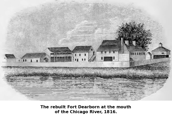
When American soldiers returned to the mouth of the Chicago River in the summer of 1816, they found little but ashes and memory. The original Fort Dearborn had been burned to the ground after the August 1812 massacre, and the handful of traders and Native families who had called the place home were scattered or dead. The new Fort Dearborn, built that year under Captain Hezekiah Bradley, was a modest wooden stockade, but its purpose was unmistakable: to reassert American control over a crossroads the United States had no intention of abandoning. The garrison brought with it a slow trickle of civilians — traders, interpreters, and a few enterprising families willing to gamble on a swampy outpost most of the country had never heard of. For nearly two decades afterward, Chicago remained what it had always been, a portage and trading post, its population rarely exceeding a few dozen white residents alongside the Potawatomi, Odawa, and Ojibwe who still dominated the surrounding country. Nothing about its physical setting — flat, wet, mosquito-ridden, prone to flooding — suggested it was destined to become anything more.
Black Hawk’s War and the Departure of the Potawatomi
The event that did more than any other to clear the way for American settlement was not a Chicago event at all — it happened along the Rock River, in 1832, when the Sauk leader Black Hawk led several hundred followers back across the Mississippi into Illinois in defiance of an earlier land cession, hoping to reclaim ancestral cornfields. The conflict that followed, brief and one-sided, barely touched Chicago directly, but it terrified the scattered settlers of the region badly enough that many fled to the rebuilt fort for protection, and it hardened American resolve to finish removing Native nations from northern Illinois altogether. The following year, 1833, US commissioners gathered thousands of Potawatomi, along with Odawa and Ojibwe delegates, at Chicago itself for the Treaty of Chicago, in which the tribes ceded the last of their remaining land in the region in exchange for reservations west of the Mississippi and cash annuities. The actual departure did not happen instantly — many families lingered for two more years — but by 1835 the last large Potawatomi encampments had left the Chicago area for good, marching west under government escort. It was a wrenching, coerced ending to thousands of years of Native presence at the confluence of river and lake, and it opened the ground on which the American city would be built.
From Trading Post to Town to City
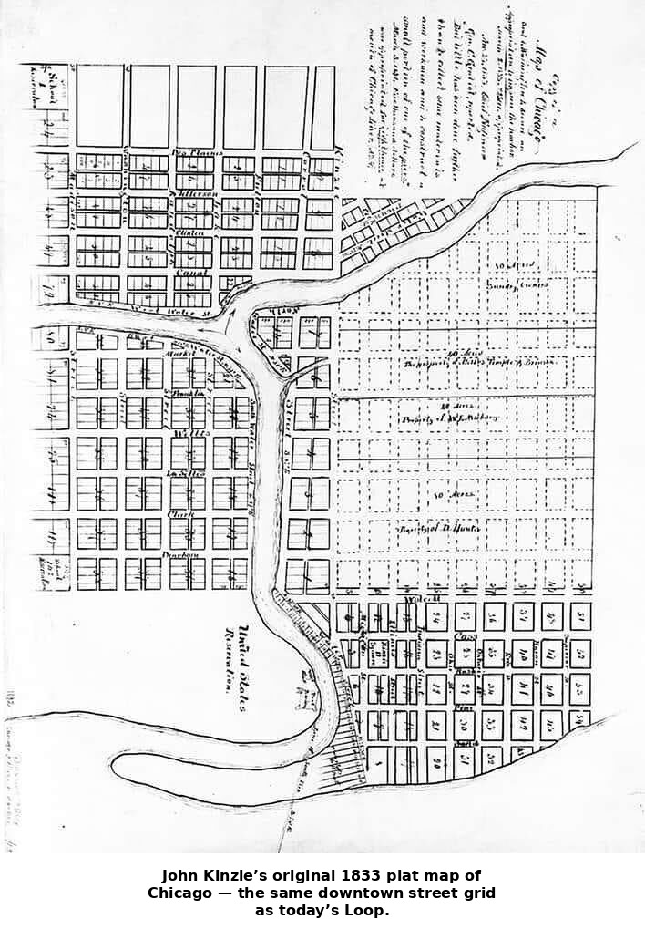
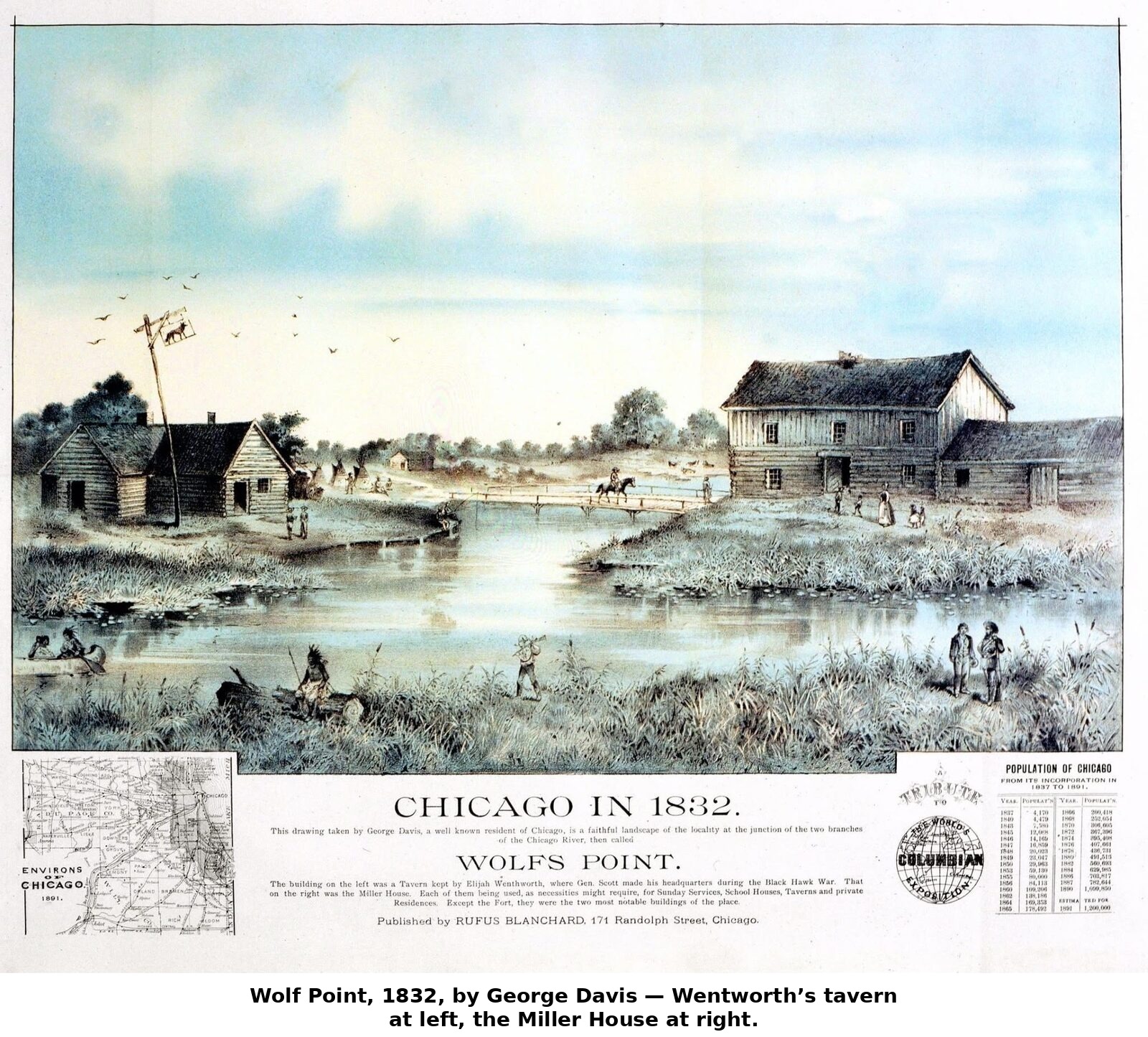
The transformation that followed was startling even to contemporaries. In 1833, the same year as the Treaty of Chicago, the tiny settlement — a few hundred residents clustered around the fort and the river mouth — organized itself as the Town of Chicago, with an elected board of trustees and a charter modest enough for a place that could still be walked end to end in a few minutes. Land speculation, however, was already becoming the town’s first real industry; plots that had sold for a few dollars in the early 1830s were changing hands for hundreds within a few years, as word spread that this swampy junction sat on the likely route of a canal connecting the Great Lakes to the Mississippi watershed. Growth outpaced the town charter almost immediately. By 1837, with a population estimated around four thousand, Chicago incorporated as a full city, electing William B. Ogden — a transplanted New Yorker and canal-land promoter — as its first mayor. The timing was brutal: the Panic of 1837 hit the same year, and the speculative land bubble that had inflated Chicago’s early growth collapsed along with banks across the country. For several lean years the young city’s finances and its half-built canal project both nearly foundered.
The Canal That Made the City
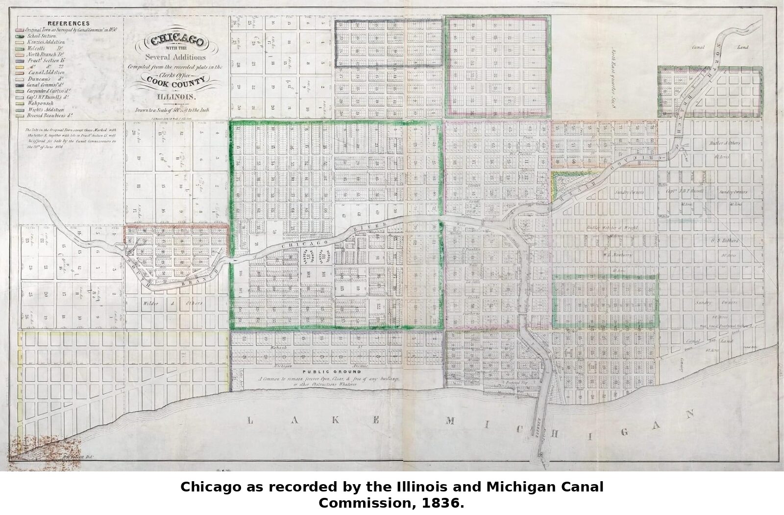

Long before the panic, Illinois legislators and Chicago boosters alike understood that the settlement’s future depended on solving one stubborn geographic problem: the portage between the Chicago River and the Des Plaines River, though short, was not navigable, meaning goods and boats had to be hauled overland between the Great Lakes system and the Mississippi system. The Illinois and Michigan Canal, authorized by the state legislature in 1836, was meant to fix that permanently, cutting a channel roughly a hundred miles long connecting Chicago to the Illinois River at LaSalle. Construction began that same year with enormous fanfare and even more enormous debt, financed substantially by land grants and bond sales tied to the very real estate speculation that would soon crash. Work slowed to a crawl during the depression years of the late 1830s and early 1840s, and the state came close to abandoning the project outright. It was finally finished in 1848, twelve years after it began, at a cost that had nearly bankrupted Illinois. The result, once it opened, was immediate and transformative: grain, lumber, and goods could now move by water all the way from the Mississippi basin to the Great Lakes and on to the Atlantic seaboard via the Erie Canal, and Chicago sat at the hinge point of that entire system. The canal did what its promoters had always promised — it turned a lakeside village into a genuine commercial gateway.
Locks, Lumber, and a River Put to Work
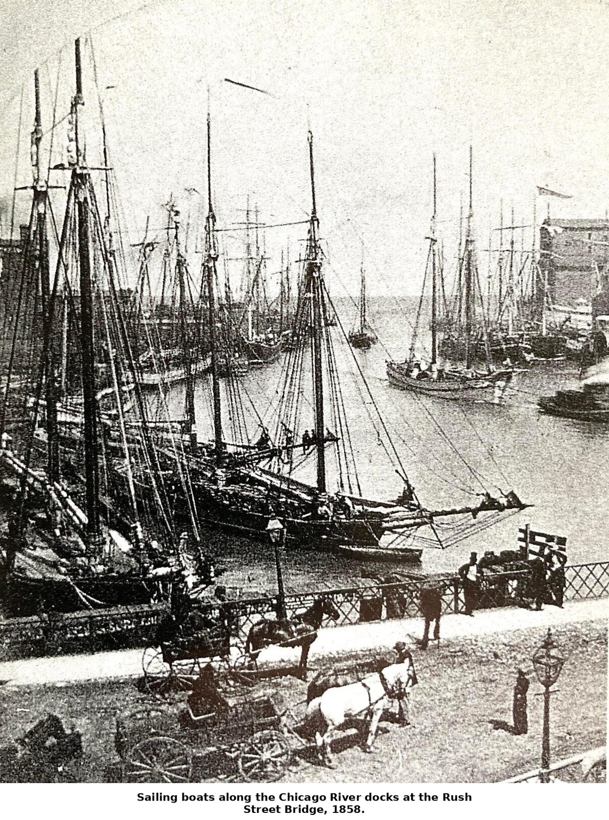
The canal’s success remade the river itself long before any dramatic reversal made headlines. At Bridgeport, where the canal met the South Branch of the Chicago River, engineers built a lock and a steam-driven pumping works to draw water from the river into the canal’s channel whenever the season’s natural flow ran too shallow for loaded barges — an arrangement that, on any day the pumps ran hard enough, quietly pulled the river’s current toward the Des Plaines instead of the lake, a modest preview of the far larger reversal the city would undertake decades later. The South Branch itself, meanwhile, became Chicago’s working waterfront: lumber schooners from the pineries of Wisconsin and Michigan tied up along its banks to unload at a sprawling lumber district that, by the 1850s, ranked among the largest lumber markets in the world, while tanneries, distilleries, and slaughterhouses upstream had already begun treating the same river as a convenient drain for their waste — a habit that would curdle into a full-blown public-health crisis within a generation.
Rails Arrive, and Everything Accelerates
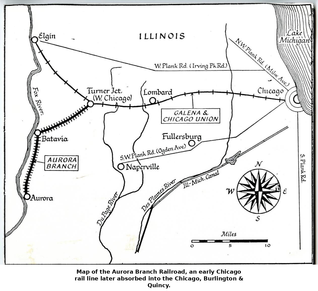
As if the timing had been arranged for maximum effect, 1848 also brought Chicago’s first railroad. The Galena and Chicago Union, chartered years earlier but stalled for want of capital, finally laid track running west out of the city, and by autumn its small locomotive, the Pioneer, was hauling wheat in from farms that had previously depended on wagon roads through mud. The railroad’s early success — it turned a profit almost immediately, since farmers were desperate for a faster route to market than canal barges or overland teamsters could offer — set off a scramble. Within a decade, a dozen rail lines radiated outward from Chicago into Illinois, Wisconsin, Iowa, and beyond, and the city’s position as the funnel through which the produce of the entire Midwest passed on its way east was essentially locked in. Canal and railroad together, arriving within the same year, did more to determine Chicago’s destiny than any other single development of the period: the canal proved the concept of Chicago as a transportation hub, and the railroad scaled it up far beyond what water transport alone could ever have managed, since rails could be built anywhere, in any season, regardless of drought or freeze.
Grain, Steam, and the Birth of the Futures Market
That same pivotal year of 1848 also gave Chicago the institution that would turn its farmers’ crops into a national commodity: the Chicago Board of Trade, founded on April 3rd as a general chamber of commerce for the young city’s merchants. For its first several years the Board did little more than set weights and settle petty trade disputes, but the flood of wheat arriving by canal and rail soon forced a more fundamental innovation. Grain had traditionally been hauled to Chicago in sacks and sold as each farmer’s own particular crop, which meant weighing, inspecting, and negotiating over every individual load, a hopeless bottleneck as volumes climbed into the millions of bushels. In 1856 the Board of Trade solved the problem by introducing a formal grading system, sorting incoming wheat into a handful of quality classes so that grain of the same grade, regardless of whose farm it came from, could be dumped together into a single elevator bin and treated as one uniform commodity. A charter granted by the Illinois legislature in 1859 gave the Board’s own inspectors binding authority to assign those grades, effectively making Chicago’s grain standard the law of the market. The change severed, for the first time, a farmer’s ownership claim from any particular physical wheat: what a seller now held was a claim on so many bushels of a given grade, a claim that could be bought, sold, and speculated on independent of any actual grain at all. That severance is precisely what made a true futures market possible, and the Board of Trade obliged in 1865, adopting standardized futures contracts and formal trading rules for margin and delivery — a model that commodity exchanges from cotton to soybeans to, eventually, financial futures would copy for the next century and beyond.
Handling that torrent of graded grain required machinery to match. Steam power, first harnessed for a grain elevator in Buffalo in 1842, reached Chicago by 1848, when the city’s first steam-driven elevator began lifting grain on a belt of buckets — “legs,” in the trade’s language — capable of moving thousands of bushels an hour, drawing wheat directly out of canal boats and rail cars and pouring it into storage bins several stories tall. A Chicago Tribune reporter touring the riverfront elevators in 1861 marveled at the scale involved, noting that the roughly twenty-eight million bushels the city’s elevators had handled the previous year, if hauled the old-fashioned way in two-bushel sacks, would form “a wall sixteen feet high and seven hundred miles long.” The elevators themselves consumed staggering quantities of a second frontier commodity, lumber — the great houses built of nothing but stacked spruce planking, framing structures containing millions of board feet apiece — tying the grain trade directly to the vast pineries of Wisconsin and Michigan that fed Chicago’s own lumber district a few blocks away. Grain, lumber, rails, and the Board of Trade’s new futures contracts together turned Chicago, within little more than a decade, from a muddy trading post into the commodity clearinghouse for the entire agricultural interior of North America.
An Astonishing Rate of Growth
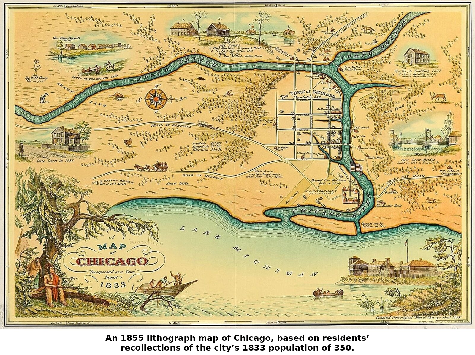
The population figures from these decades are almost hard to believe. Chicago counted perhaps 350 residents when it incorporated as a town in 1833. By the time of city incorporation in 1837 that figure had grown roughly tenfold. By 1850, with the canal newly open and the railroad boom underway, the city’s population had reached about 30,000. Twenty years later, in 1870, it stood at nearly 300,000 — a hundredfold increase in less than four decades from its town-charter days, and among the fastest sustained urban growth rates the country had ever seen. Immigration drove much of this surge: Irish laborers who had come to dig the canal stayed on afterward, German immigrants arrived in large numbers throughout the 1840s and 1850s fleeing political upheaval and economic hardship in Europe, and a steady stream of native-born New Englanders and New Yorkers came west chasing opportunity in real estate, grain trading, and lumber. The city that had been a muddy fort a generation earlier was rapidly becoming one of the significant urban centers of the entire country, its downtown filling with brick storefronts, hotels, and the beginnings of a distinct commercial district along the river.
Raising the City Out of the Mud
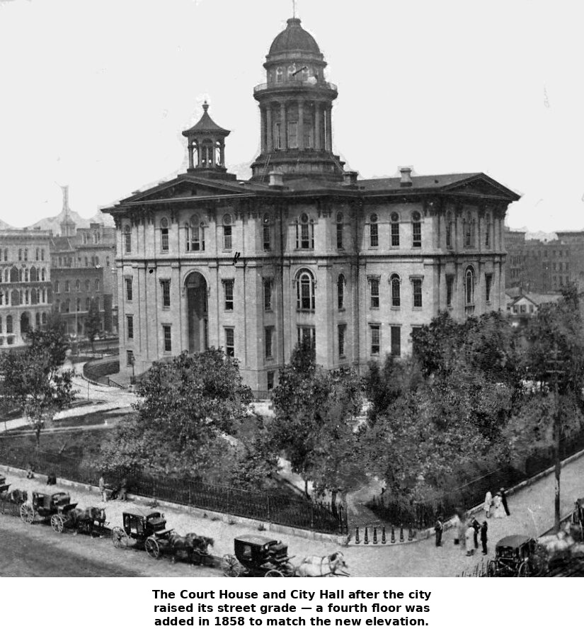
Rapid growth brought a problem that could not be solved by ambition alone: Chicago sat on flat, poorly drained, often swampy ground barely above lake level, and its early wooden buildings and dirt streets turned into seas of mud with every rain. By the 1850s the situation had become a public health crisis as much as an engineering embarrassment, since standing water and inadequate drainage were blamed, correctly, for outbreaks of cholera and other disease. The solution the city settled on was audacious: rather than dig sewers underground, which the wet soil made nearly impossible, engineers led by men such as Ellis Chesbrough decided to raise the entire grade of the city several feet, laying new sewers on top of the old ground level and then bringing streets, sidewalks, and eventually whole buildings up to match. Through the late 1850s and into the 1860s, Chicago underwent the surreal spectacle of entire brick buildings, some of them massive hotels, being jacked up on hundreds of screw jacks and raised several feet into the air while business inside continued uninterrupted, block by block, until the city’s grade had been lifted well above its original swampy footing. It remains one of the more remarkable feats of urban engineering of the era, and it gave Chicago something few rapidly growing American cities of the time had: a workable sewer system and a fighting chance against the diseases that plagued unplanned nineteenth-century cities.
Mayors, Machines in Miniature, and the Lager Beer Riot
Chicago’s earliest municipal politics were small-scale and fast-turning: the town incorporated in 1833, the city charter followed in 1837, and William B. Ogden, a Democrat and railroad promoter who had helped draft that first charter, won election as Chicago’s first mayor, defeating the Whig incumbent town president John H. Kinzie. Under the weak-mayor charter of these decades, real power sat with a City Council of ward aldermen, and mayors served single-year terms in a rapid, boosterish churn that mirrored the town’s own restless growth rather than any settled system of governance. That churn turned genuinely violent in 1855, when Levi Boone, elected mayor on the nativist, anti-immigrant “Know-Nothing” American Party ticket, moved to enforce a long-dormant Sunday closing law and raised liquor license fees sixfold, measures aimed squarely at the taverns and beer gardens of the city’s fast-growing German and Irish population. When police began arresting tavern keepers that April, several hundred angry Germans marched on the courthouse in what became known as the Lager Beer Riot; the ensuing clash left one rioter dead and dozens arrested before order was restored. Boone’s ordinance was repealed within the year, and the episode discredited nativist politics in Chicago for a generation, helping cement a durable alliance between the city’s Democratic Party and its immigrant voters that would shape Chicago politics for the rest of the century.
Chicago and the Civil War
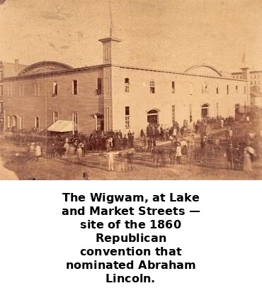
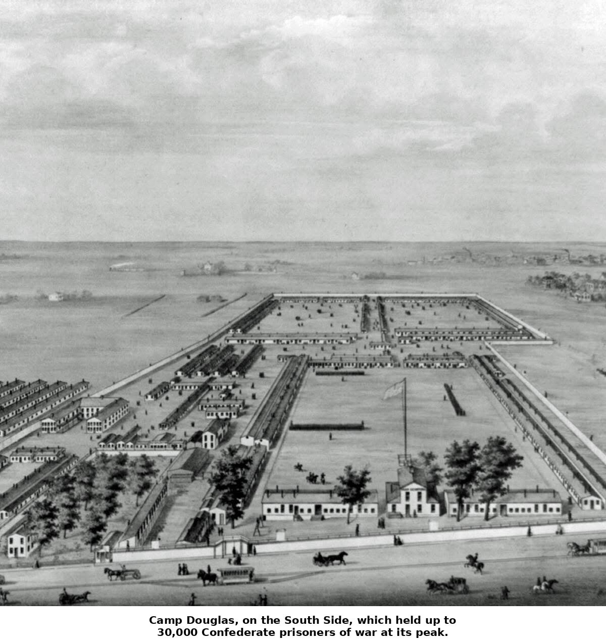

By the time the Civil War broke out in 1861, Chicago’s transportation network made it a natural hub for the Union war effort. Camp Douglas, established on the city’s South Side on land associated with the late Senator Stephen A. Douglas, began as a training and mustering camp for Illinois volunteers and later became one of the largest Union prison camps for captured Confederate soldiers, housing thousands of prisoners under conditions that grew notoriously harsh as the war dragged on. Beyond the camp itself, the war accelerated Chicago’s emergence as a meatpacking and grain-shipping powerhouse, as the Union Army’s need to feed and supply its armies funneled enormous contracts through the city’s stockyards, mills, and rail lines. The war years, far from slowing Chicago’s growth, poured fuel on it, cementing the city’s role as the logistical engine feeding the western armies and setting up the postwar decades in which Chicago’s meatpacking and grain-trading industries would become globally dominant.
From Frontier Post to Metropolis

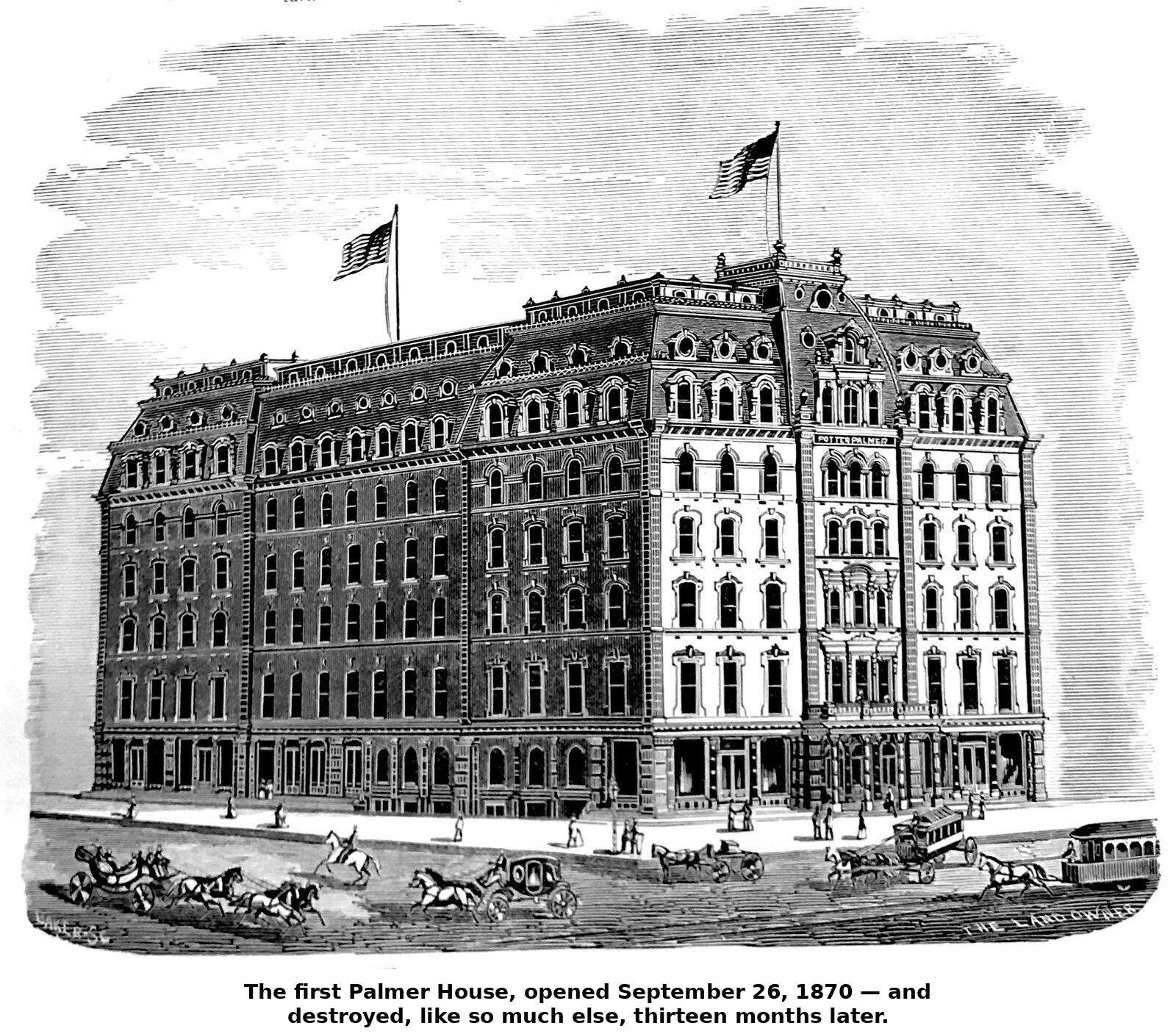
Taken together, the years between 1813 and 1870 are the period in which Chicago stopped being a contingent, fragile frontier outpost and became something that looked, unmistakably, like a permanent American metropolis. The rebuilding of Fort Dearborn reasserted an American claim to the site; the Black Hawk War and the Treaty of Chicago cleared away the last organized Native presence that might have contested it; incorporation as town and then city gave the settlement the legal and institutional scaffolding to grow; and the twin arrival of the canal and the railroad in 1848 gave it an economic engine — control over the flow of goods between the Mississippi Valley and the Great Lakes — that no rival city in the region could match. The explosive population growth of the 1840s and 1850s, and the sheer civic will required to physically raise the city out of its own mud, show a place remaking itself at a pace almost without precedent in American history. By 1870, the frontier trading post of 1813 was gone entirely, replaced by a booming rail and grain metropolis of nearly 300,000 people — a city confident enough in its own momentum that even the catastrophe of the Great Fire, waiting just one year ahead, would prove only a pause rather than an ending.
Sources: A.T. Andreas, History of Chicago: From the Earliest Period to the Present Time, Vol. 1 (1884); Henry H. Hurlbut, Chicago Antiquities: Comprising Original Items and Relations, Letters, Extracts, and Notes, Pertaining to Early Chicago (1881); Joseph Kirkland, The Story of Chicago (1892); William Cronon, Nature’s Metropolis: Chicago and the Great West (1991); Francesca Gamber et al., Nature’s Metropolis at 30, Commonplace (2021); Chicago Tribune, “Our Grain Elevators” (1861), reproduced with additional history at Chicagology.com; general reference sources on the Illinois and Michigan Canal, the Galena and Chicago Union Railroad, and Camp Douglas; Libby Hill, The Chicago River: A Natural and Unnatural History (2000); Emmett Dedmon, Fabulous Chicago (1953); general reference sources on Mayor Levi Boone and the 1855 Lager Beer Riot.
Photo Sources: The rebuilt Fort Dearborn, 1816 — Wisconsin Historical Society; Kinzie’s 1833 plat map of Chicago — Illinois State Archives, Illinois and Michigan Canal Commission records; Wolf Point, 1832 (George Davis) — Chicago History Museum; Illinois and Michigan Canal Commission map, 1836 — Newberry Library, Chicago; The Court House and City Hall after the 1858 grade raise — Chicago History Museum (Alexander Hesler); The Wigwam, 1860 — Chicago History Museum (Alexander Hesler); Camp Douglas — Library of Congress, Liljenquist Family Collection of Civil War Photographs; Lincoln lying in state, 1865 — Library of Congress (photograph by S. M. Fassett); The first Palmer House, 1870 — Chicago History Museum. Internet sources of other photos are not identified.
← Previous: Chapter 1, Colonial Chicago | Introduction | Next: Chapter 3, Post-Fire Chicago →