
Chapter 1: Colonial Chicago, 1688–1812
A Meeting Place Long Before It Was a City
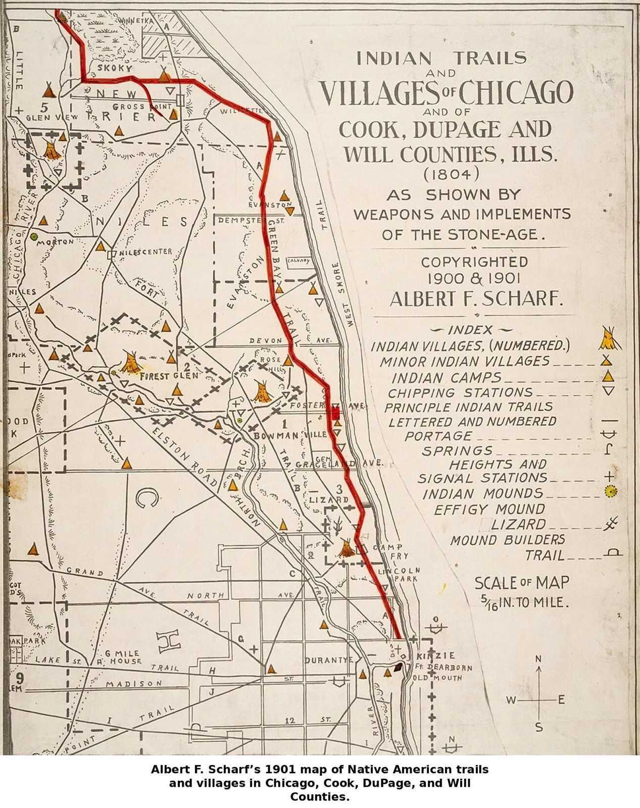
Centuries before Chicago existed as a town, the marshy ground where the Chicago River met Lake Michigan was already important, just not to Europeans. The Potawatomi were the dominant people of the region by the time written records begin, part of a wider network that included the Illinois Confederacy, the Miami, and others who hunted, traveled, and traded across the area. A Jesuit missionary, Father Claude Allouez, recorded meeting a village of some eighty Illinois Indians near the Illinois River as early as 1677, a reminder that “Chicago” was Native ground for thousands of years before it was anyone’s colonial outpost. The very name of the place is itself Native in origin, an Algonquian word usually translated as referring to the wild garlic or onion that grew along the riverbanks.
When European traders and soldiers eventually arrived, they were entering a landscape that already had its own trade routes, alliances, and rivalries. The story of early Chicago is, from the start, a story of contact and negotiation between these worlds, one that would end, in 1812, in violence.
The French Arrive: Marquette, Jolliet, and the Portage
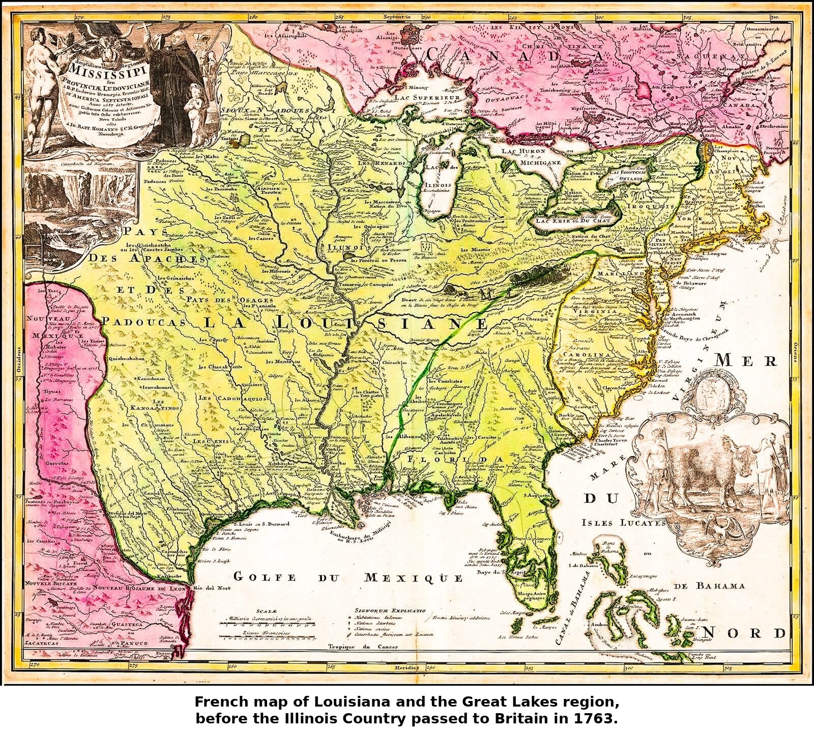
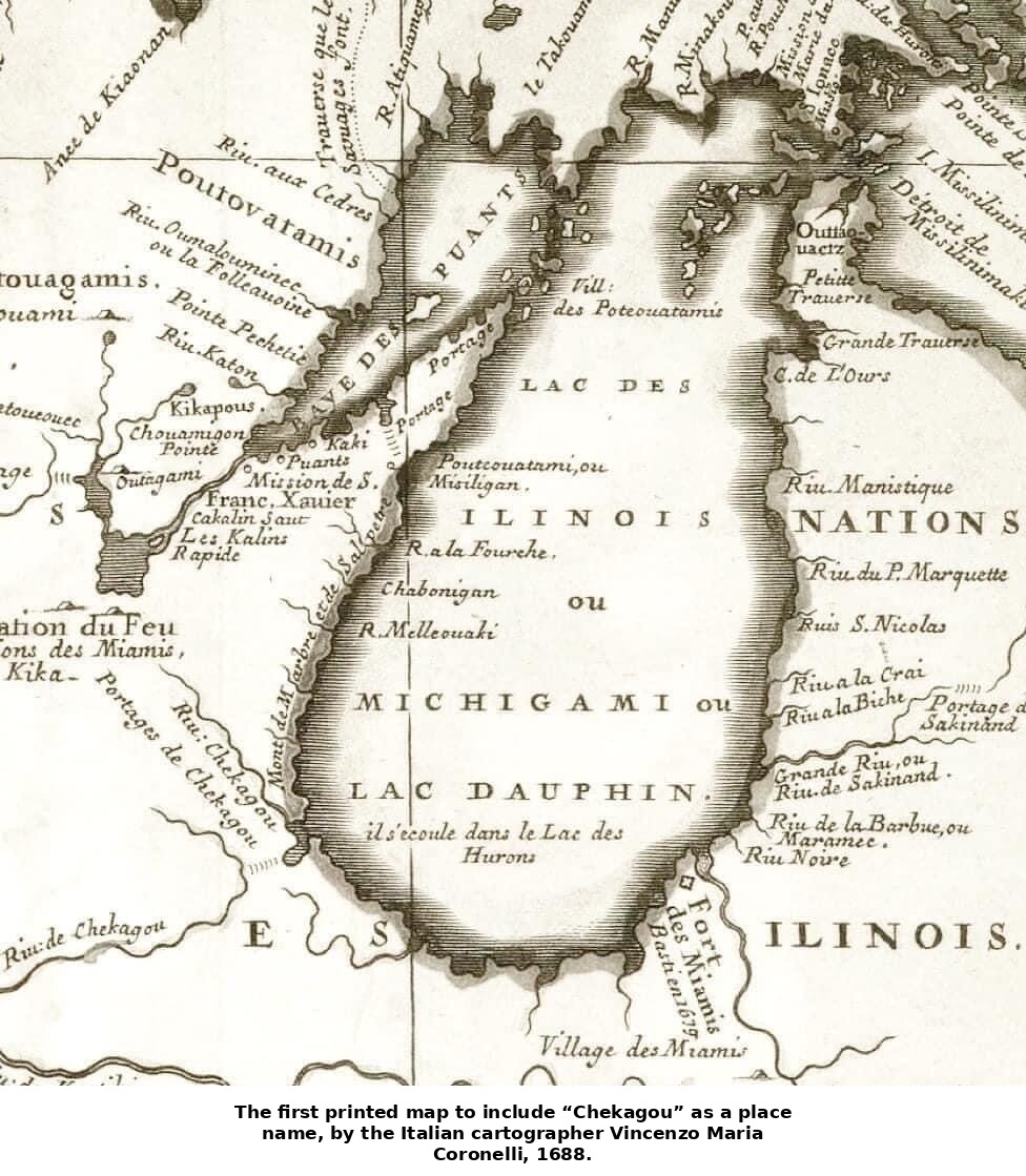
Chicago’s first appearance in the historical record comes from that contact. In the spring of 1673, Louis Jolliet, commissioned by the French colonial administration to search for a great western river, set out from the Straits of Mackinac with the Jesuit missionary Father Jacques Marquette and five companions. They paddled down the Fox and Wisconsin Rivers to the Mississippi, then followed it south nearly to the Arkansas River before turning back, wary of Spanish territory ahead. On their return journey, guided by local Native travelers, they came back north by way of the Illinois River and, most likely, the short overland portage that separated it from the Chicago River. By tradition, they became the first Europeans to cross the ground that would become downtown Chicago.
Marquette returned to the site in December 1674, fell seriously ill, and ended up spending the winter camped near the portage — the first extended stay by a European in the area, though he almost certainly sheltered in a Native-style wigwam rather than any log structure, whatever later, more romantic accounts suggested. He was not entirely alone even then: he found two French traders already living a short distance downstream, evidence that the portage was already becoming known to fur traders even before it had a name that would stick. A few years later, the more famous and more ruthless René-Robert Cavelier, Sieur de La Salle, also crossed the portage on his own expeditions to claim the Mississippi valley for France — a contrast historians have long drawn between the “gentle, saintly” Marquette and the “masterful,” empire-building La Salle. Between them, the two Frenchmen set the terms by which Europe would first understand this stretch of prairie: not as a place to settle, but as a route to somewhere else.
Why Here? The Geography That Made a Metropolis
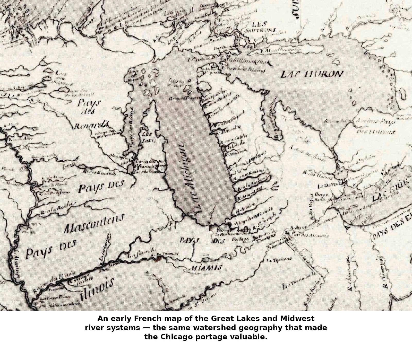
That last point is the key to everything that follows. Chicago’s location was, for more than a century, valuable almost entirely because of what lay on either side of it. The Chicago Portage was one of only a handful of places where a canoe, and later a wagon, could cross from the Great Lakes and St. Lawrence watershed into the Mississippi and Gulf of Mexico watershed without a long overland haul. Through the Chicago and Des Plaines Rivers, a traveler could more easily access the interior of the continent. Contemporary accounts from the early 1700s describe the portage as a matter of a few miles in dry weather, sometimes stretching to nine miles when the marshes dried out. However, in wet seasons a paddler could sometimes make their way through flooded sedge grass from the lake nearly all the way to the Des Plaines River without ever setting foot on land.
One historian later called it one of “the keys of the continent.” It’s not an exaggeration to say that this marshy, often-flooded gap explains why a city arose here rather than at any of a dozen equally flat, equally lakeside spots along Lake Michigan’s shore. When Jolliet returned from his 1673 expedition, he proposed cutting a short canal to make the connection permanent. This idea came to fruition a century and a half later when the Illinois and Michigan Canal was built. After that the same logic brought Chicago’s railroads, but the portage came first. Everything else about Chicago’s later growth as a transportation hub follows from it.
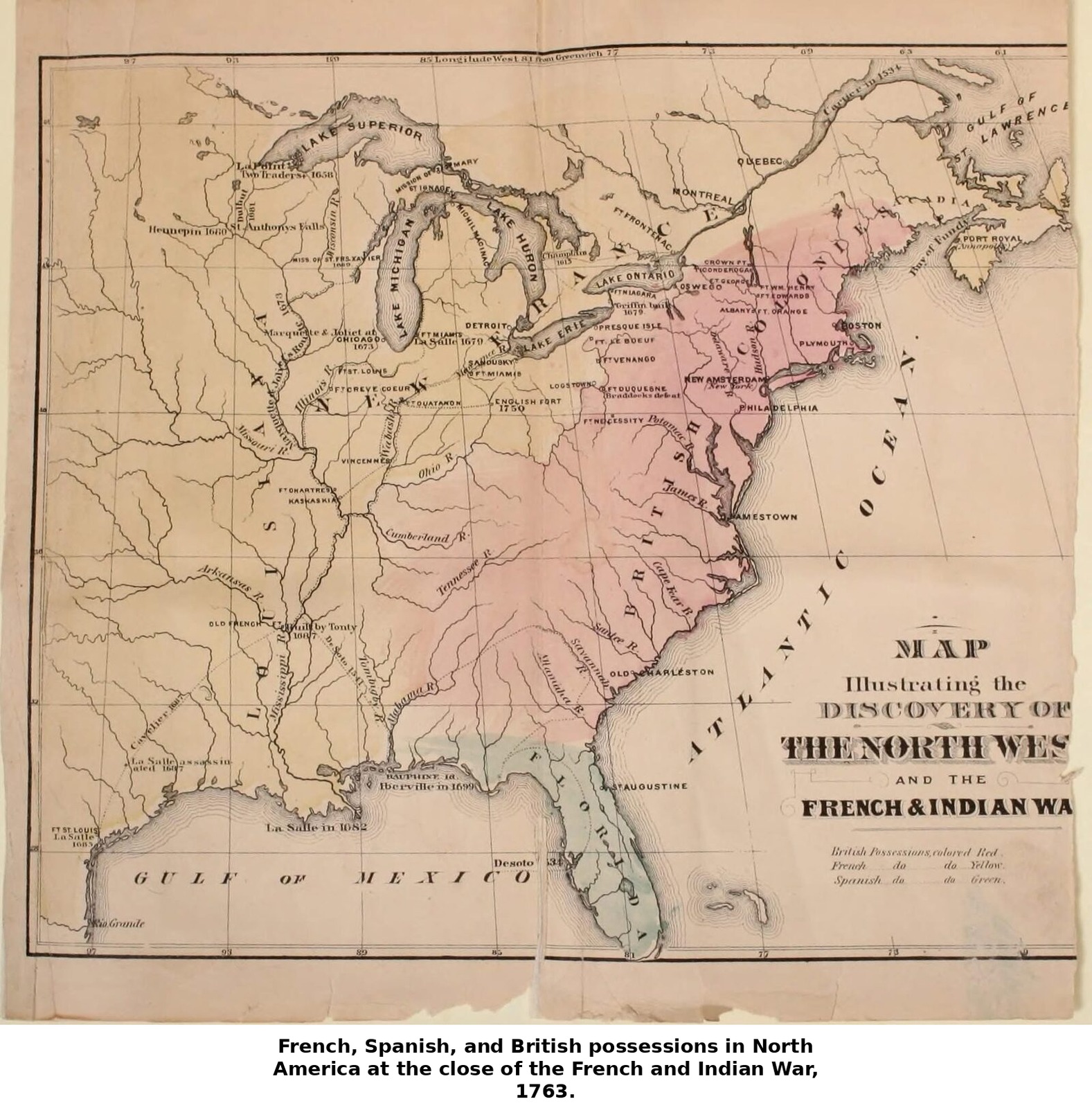
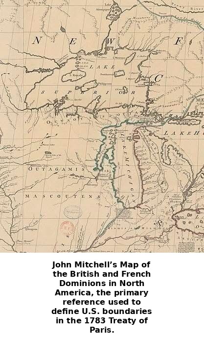
Sovereignty over that gap changed hands twice more before Chicago was truly a town. France ceded its claim to the territory east of the Mississippi to Great Britain in 1763 at the close of the French and Indian War; two decades later the map was redrawn again when the 1783 Treaty of Paris — for which the British cartographer John Mitchell’s sweeping wall map of North America served as the primary boundary reference — transferred the region to the newly independent United States as part of the old Northwest Territory. The portage itself never moved; only the flags claiming it did.
Traders and a Fort: Du Sable, Kinzie, and Fort Dearborn
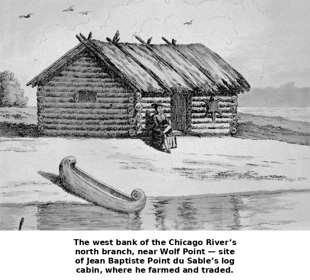
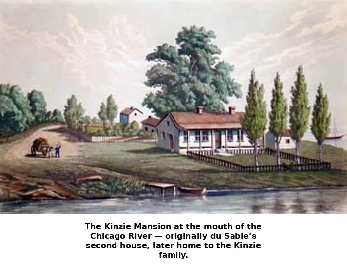
For most of the eighteenth century, the portage’s few visitors were fur traders passing through rather than settlers staying put. That changed when Jean Baptiste Point du Sable, a trader of French and African descent born around 1745 in present-day Haiti, by the 1780s had built a substantial and prosperous trading post at the mouth of the Chicago River. A visiting trader’s journal from 1790 describes finding it well stocked with goods. Du Sable married a Potawatomi woman named Kitihawa, and is today recognized as Chicago’s first permanent non-Native resident and its founder. He sold his post and left the area around 1800. The property eventually came into the possession of John Kinzie, a trader who moved his family to Chicago in 1803 and became for the next decade the settlement’s most prominent civilian resident.
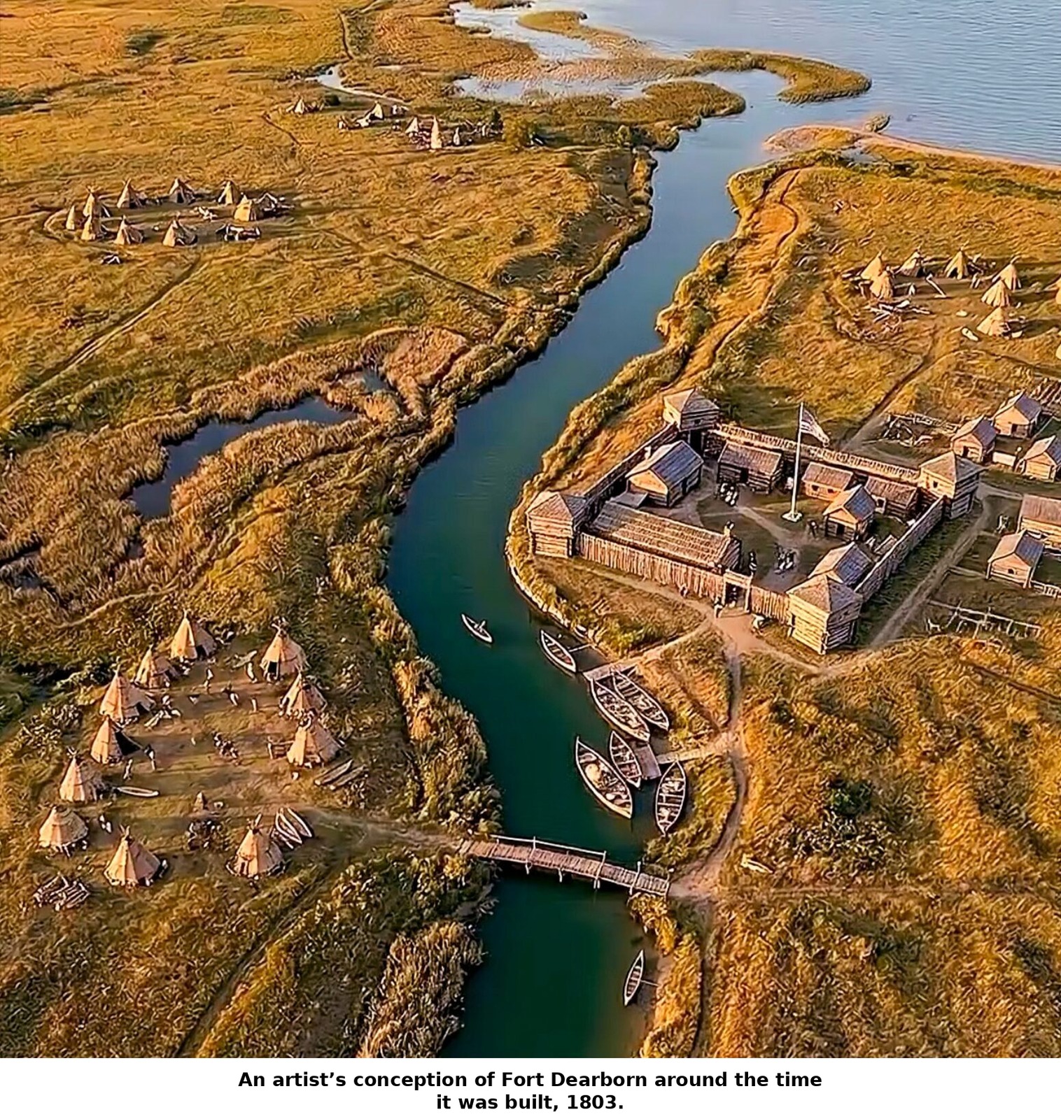
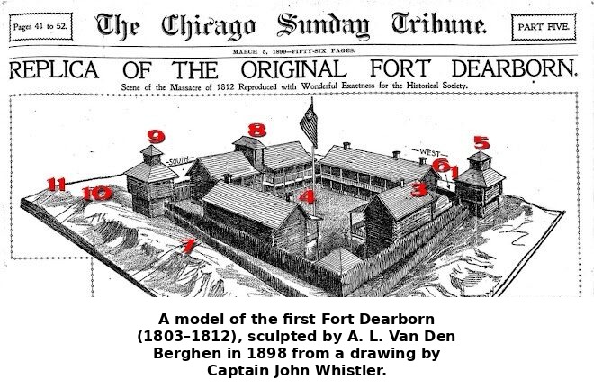
Kinzie’s arrival came the same year the United States Army built the first Fort Dearborn. It was a modest log stockade on the river’s south bank, built to secure American claims in the region following the Louisiana Purchase and to manage relations with the surrounding tribes. The first fort was smaller than the one later rebuilt to replace it in 1816. It had two blockhouses and a covered underground passage down to the Chicago River. This gave the garrison access to water even when the fort was under siege, a detail that suggests the Army understood exactly how exposed this small post really was. Kinzie’s own house stood just across the river from the fort. Nearby was an outlying farm known as “Lee’s Place.” By 1812 it was a small community with a fort garrison, a trading family, a handful of other settlers. Around them for miles in every direction were the far larger and more numerous Potawatomi and allied villages on whose goodwill the whole outpost quietly depended.
War Comes to the Portage: The Fort Dearborn Massacre
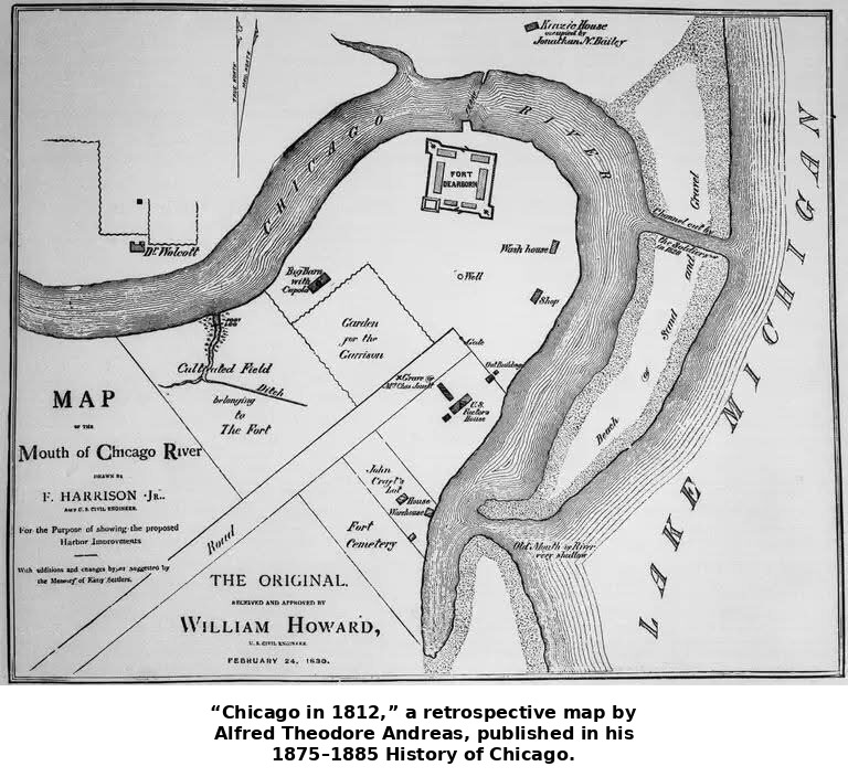
In the summer of 1812, the United States declared war on Britain and the isolated garrisons of the old Northwest were far from possible reinforcement and surrounded by tribes that British agents had spent years courting. They were suddenly vulnerable.
On August 8, Fort Dearborn’s commander, Captain Nathan Heald, received an order from General William Hull, carried to him by a Potawatomi chief named Winnemeg. It instructed him to abandon the fort and march to Fort Wayne in what is now Indiana and distribute the fort’s goods to the surrounding tribes as he left. On August 12, Captain William Wells arrived from Fort Wayne with a company of Miami warriors as an escort. With roughly five hundred Potawatomi gathered near the fort and its caches of muskets, artillery, gunpowder, and provisions, Wells thought the situation had become dangerous. At his and Kinzie’s urging, Heald reversed his earlier plan. On the night of August 13, he had the fort’s weapons, liquor, and ammunition destroyed rather than handed over to the Potawatomi, a decision that angered the assembled Potawatomi the following morning.
That night, a Potawatomi leader named Black Partridge came privately to Heald and returned the peace medal the Americans had given him. In words later recorded by an officer who survived the battle, he said he could no longer restrain his younger warriors and would not wear a token of peace while forced to act as an enemy. Heald did not share this warning with his own officers.
On the morning of August 15, 1812, the garrison evacuated anyway, with fifty-two soldiers, four officers and a surgeon, a handful of other settlers, nine women, and eighteen children, marching south along the lakeshore prairie with their Miami escort. About a mile and a half from the fort, Wells, riding ahead, signaled that they were surrounded, and the attack began almost immediately. Within minutes, all but a handful of the soldiers were killed or wounded. The fighting was brutal and, by every surviving account, a massacre carried out at close range between people who had lived near one another for years. Roughly two dozen soldiers died in the initial fighting, along with a number of the civilians traveling with them; the wounded who could not be moved were killed where the column had stopped.
Lieutenant Linai Helm, Kinzie’s son-in-law, was wounded and captured, but his wife survived, hidden and protected by the Potawatomi leader Black Partridge. Heald and his wife were eventually released and made their way east by a long, route through St. Joseph and Mackinac. The fort itself was burned to the ground, though it was later rebuilt on a larger scale in 1816.
A Small, Violent Beginning
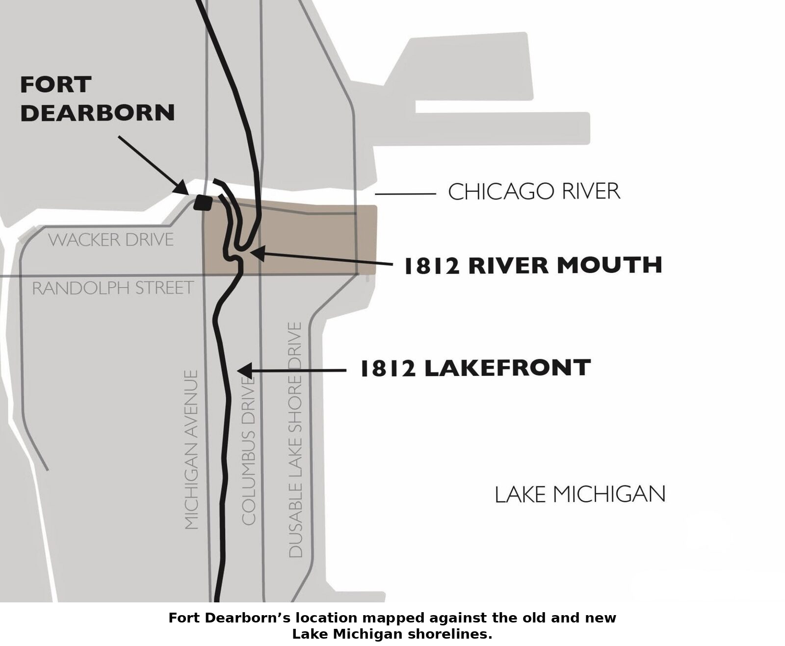
In August 1812, “Chicago” was a fort, a trading house, a scattering of families, and a few miles of prairie. The non-Native population numbered in the dozens, and the event that would come to define this period in local memory took less than an hour. And yet nearly everything that followed depended on what happened here in this early period. The portage that made the site worth fighting over in the first place was discovered. The traders who first came this way saw its commercial promise. And the early accommodation among the settlers and the Potawatomi failed with the Fort Dearborn massacre. Chicago’s later explosive growth as a railroad and shipping hub was predestined given a geographic fact the Potawatomi, the French, and the Army had all separately recognized more than a century earlier. Whoever controlled this narrow, marshy gap in the landscape controlled central passage between two halves of the North American continent.

Sources: Milo M. Quaife, Chicago and the Old Northwest, 1673–1835 (1913); Juliette Kinzie, Wau-Bun: The “Early Day” in the North-West (1856); Lieutenant Linai T. Helm’s narrative of the Fort Dearborn massacre; general reference sources on Jean Baptiste Point du Sable.
Photo Sources: Coronelli’s 1688 map of the Great Lakes — Newberry Library, Chicago; Mitchell’s Map of the British and French Dominions in North America — Library of Congress, Geography and Map Division; Scharf’s 1901 map of Native American trails — Chicago History Museum; The Kinzie Mansion — Wisconsin Historical Society; also held via Calisphere; Fort Dearborn, 1803 (artist’s conception) — Chicago History Museum; Model of the first Fort Dearborn — Chicago History Museum, Crossroads of America exhibit; “Chicago in 1812” (Andreas map) — A. T. Andreas, History of Chicago (1884); Newberry Library / Chicago Public Library. Internet sources of other photos are not identified.