Vintage ChicagoA Cliff Dweller's History in photographs Open the interactive map ›

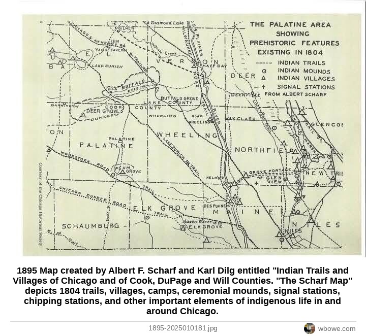
1895Map created by Albert F. Scharf and Karl Dilg entitled "Indian Trails and Villages of Chicago and of Cook, DuPage and Will Counties
1895 Map created by Albert F. Scharf and Karl Dilg entitled "Indian Trails and Villages of Chicago and of Cook, DuPage and Will Counties

1895 Map created by Albert F. Scharf and Karl Dilg entitled "Indian Trails and Villages of Chicago and of Cook, DuPage and Will Counties. "The Scharf Map" depicts 1804 trails, villages, camps, ceremonial mounds, signal stations, chipping stations, and other important elements of indigenous life in and around Chicago.

Greater Chicago, Chicago · Post-Fire Chicago, 1871–1900

See it on the Vintage Chicago mapAll Greater Chicago photos

← 1892 Period Map of Old Chicago→ 1895 Map created by Albert F. Scharf and Karl Dilg entitled "Indian Trails and Villages of Chicago and of Cook, DuPage and Will Counties