1895Map created by Albert F. Scharf and Karl Dilg entitled "Indian Trails and Villages of Chicago and of Cook, DuPage and Will Counties
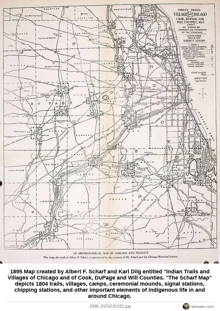
1895 Map created by Albert F. Scharf and Karl Dilg entitled "Indian Trails and Villages of Chicago and of Cook, DuPage and Will Counties. "The Scharf Map" depicts 1804 trails, villages, camps, ceremonial mounds, signal stations, chipping stations, and other important elements of indigenous life in and around Chicago.