Vintage ChicagoA Cliff Dweller's History in photographs Open the interactive map ›

1787Northwest Territory map, Illinois & Michigan Canal exhibit in LaSalle
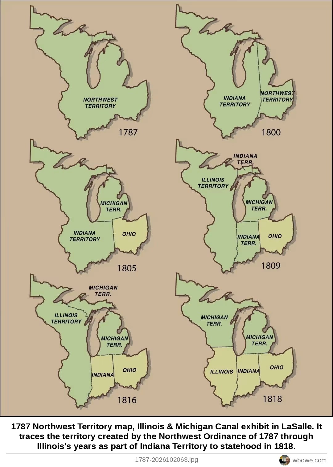
1787 Northwest Territory map, Illinois & Michigan Canal exhibit in LaSalle

1787 Northwest Territory map, Illinois & Michigan Canal exhibit in LaSalle. It traces the territory created by the Northwest Ordinance of 1787 through Illinois's years as part of Indiana Territory to statehood in 1818.

Greater Chicago, Chicago · Colonial Chicago, 1688–1812

See it on the Vintage Chicago mapAll Greater Chicago photos

← 1784 Early map of the western Great Lakes region showing major river basins→ 1790 Map showing the Northwest Territory and then current boundaries of a small coastal republic surrounded by foreign colonial powers