1884Map published by Frank Glossop
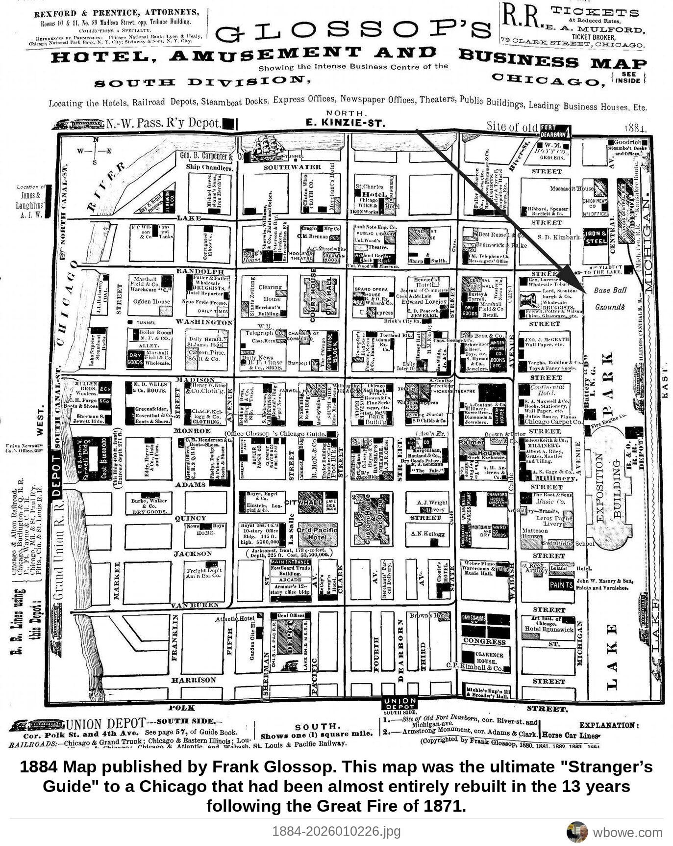
1884 Map published by Frank Glossop. This map was the ultimate "Stranger’s Guide" to a Chicago that had been almost entirely rebuilt in the 13 years following the Great Fire of 1871.
See it on the Vintage Chicago map▶ Play the Loop slideshowAll Loop photos
← 1884 State and Monroe Streets→ 1884 Was the Home Insurance Building the world's First Skyscraper? An Inland Architect, Supplement in September, 1884 hailed the unique structural design of architect William Le Baron Jenney this way: "The construction is especially designed for a tall, heavy building set upon a compressible foundation, which this is. Such construction must be elastic, as settlements must take place, and although every care is taken to make settlements uniform, there will be more or less inequality, and to counteract these there must be elasticity in the construction. It is also necessary to have all rooms as well lighted as is possible, and this is mainly accomplished by having the piers cut away to the minimum of strength. To satisfy these two requirements the girders are carried on square iron columns built into the brick piers and connected at the top of each window by lintels. Each floor of beams and girders is tied together and also tied to all the columns, thus forming a complete network supplemented by heavy hoop-iron, built into the brickwork in every place where increased bond or tie is desired, and also every stone is clamped or anchored so that settlement will produce as little displacement as possible."