1870Block bounded by LaSalle, Washington, Dearborn, and Randolph Streets
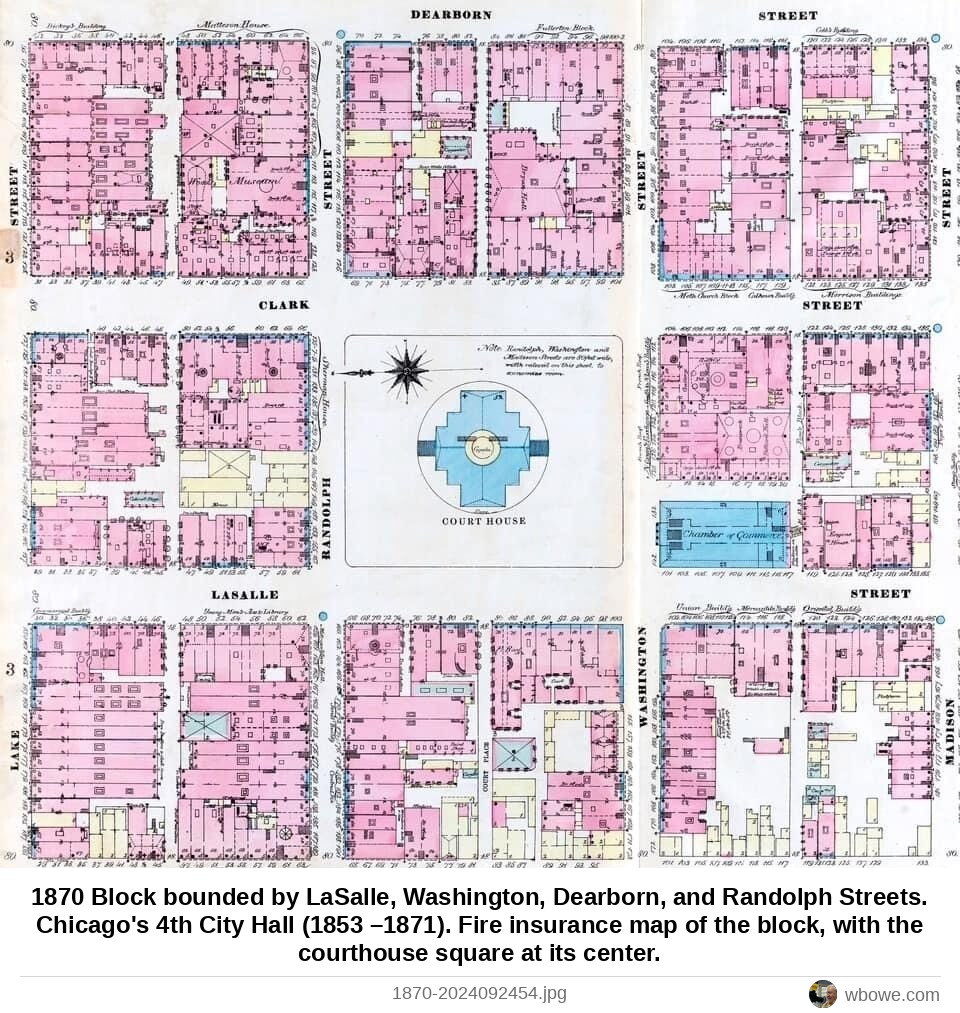
1870 Block bounded by LaSalle, Washington, Dearborn, and Randolph Streets. Chicago's 4th City Hall (1853 –1871). Fire insurance map of the block, with the courthouse square at its center.
See it on the Vintage Chicago map▶ Play the Loop slideshowAll Loop photos