1830Early Map of Chicago
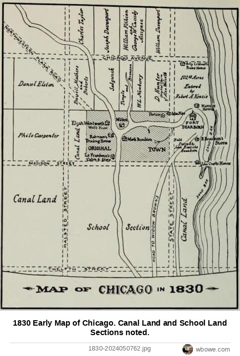
1830 Early Map of Chicago. Canal Land and School Land Sections noted.
See it on the Vintage Chicago map▶ Play the Loop slideshowAll Loop photos
1830 Early Map of Chicago. Canal Land and School Land Sections noted.
See it on the Vintage Chicago map▶ Play the Loop slideshowAll Loop photos